Unionville, Ohio | |
|---|---|
 Unionville  Unionville | |
| Coordinates: 40°51′19″N 80°44′14″W / 40.85528°N 80.73722°W | |
| Country | United States |
| State | Ohio |
| County | Columbiana |
| Township | Fairfield |
| Elevation | 1,174 ft (358 m) |
| Time zone | UTC-5 (Eastern (EST)) |
| • Summer (DST) | UTC-4 (EDT) |
| Area code(s) | 234 & 330 |
| GNIS feature ID | 1065409[1] |
Unionville is an unincorporated community in Columbiana County, Ohio, United States. Unionville is located on Ohio State Route 164, 3.2 miles (5.1 km) southwest of Columbiana.[2]
Unionville was originally called Cool Springs, on account of there being a spring near the original town site.[3]
References
- ↑ "Unionville". Geographic Names Information System. United States Geological Survey, United States Department of the Interior.
- ↑ Official Transportation Map (PDF) (Map). Ohio Department of Transportation. 2011. Retrieved April 23, 2013.
- ↑ History of Columbiana County, Ohio: With Illustrations and Biographical Sketches of Some of Its Prominent Men and Pioneers. Unigraphic. 1879. p. 142.
Municipalities and communities of Columbiana County, Ohio, United States | ||
|---|---|---|
| Cities | 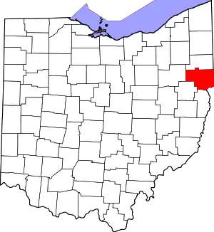 Map of Ohio highlighting Columbiana County | |
| Villages | ||
| Townships | ||
| CDPs | ||
| Unincorporated communities |
| |
| Ghost town | ||
| Footnotes | ‡This populated place also has portions in an adjacent county or counties | |
This article is issued from Wikipedia. The text is licensed under Creative Commons - Attribution - Sharealike. Additional terms may apply for the media files.