Usharal
Үшарал | |
|---|---|
Town | |
 Entrance Sign to the town. | |
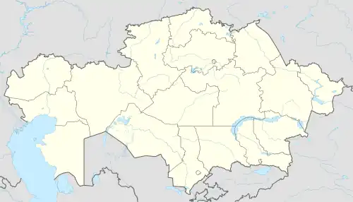 Usharal Location in Kazakhstan | |
| Coordinates: 46°10′11″N 80°56′22″E / 46.16972°N 80.93944°E | |
| Country | Kazakhstan |
| Region | Jetisu Region |
| District | Alakol District |
| Population (2009) | |
| • Total | 15,991 |
| Time zone | UTC+6 (Omsk Time) |
| Postal code | 040200 |
| Area code | 72833 |
Usharal or Üşaral (Kazakh: Үшарал, Üşaral; Russian: Ушарал) is a town in the Alakol District of Jetisu Region in south-eastern Kazakhstan. It is the capital of the district. Population: 15,991 (2009 Census results);[1] 15,379 (1999 Census results).[1]
Climate
| Climate data for Usharal (1991–2020, extremes 1934–present) | |||||||||||||
|---|---|---|---|---|---|---|---|---|---|---|---|---|---|
| Month | Jan | Feb | Mar | Apr | May | Jun | Jul | Aug | Sep | Oct | Nov | Dec | Year |
| Record high °C (°F) | 8.7 (47.7) |
13.5 (56.3) |
26.2 (79.2) |
36.4 (97.5) |
38.2 (100.8) |
39.9 (103.8) |
41.8 (107.2) |
43.6 (110.5) |
40.2 (104.4) |
31.4 (88.5) |
24.8 (76.6) |
14.4 (57.9) |
43.6 (110.5) |
| Mean daily maximum °C (°F) | −7.0 (19.4) |
−3.8 (25.2) |
5.3 (41.5) |
18.2 (64.8) |
24.3 (75.7) |
29.9 (85.8) |
31.8 (89.2) |
30.7 (87.3) |
24.9 (76.8) |
16.4 (61.5) |
5.7 (42.3) |
−2.9 (26.8) |
14.5 (58.1) |
| Daily mean °C (°F) | −12.3 (9.9) |
−9.4 (15.1) |
−0.3 (31.5) |
11.0 (51.8) |
17.0 (62.6) |
22.6 (72.7) |
24.4 (75.9) |
22.7 (72.9) |
16.7 (62.1) |
8.8 (47.8) |
0.0 (32.0) |
−7.4 (18.7) |
7.8 (46.0) |
| Mean daily minimum °C (°F) | −17.5 (0.5) |
−14.7 (5.5) |
−5.5 (22.1) |
3.8 (38.8) |
9.3 (48.7) |
14.8 (58.6) |
16.8 (62.2) |
14.7 (58.5) |
8.7 (47.7) |
2.2 (36.0) |
−4.7 (23.5) |
−11.8 (10.8) |
1.3 (34.3) |
| Record low °C (°F) | −43.0 (−45.4) |
−43.7 (−46.7) |
−32.2 (−26.0) |
−14.8 (5.4) |
−3.7 (25.3) |
1.4 (34.5) |
7.8 (46.0) |
−0.8 (30.6) |
−5.5 (22.1) |
−16.5 (2.3) |
−35.8 (−32.4) |
−43.0 (−45.4) |
−43.7 (−46.7) |
| Average precipitation mm (inches) | 32 (1.3) |
25 (1.0) |
23 (0.9) |
29 (1.1) |
26 (1.0) |
26 (1.0) |
29 (1.1) |
15 (0.6) |
11 (0.4) |
24 (0.9) |
34 (1.3) |
37 (1.5) |
311 (12.2) |
| Mean monthly sunshine hours | 138 | 158 | 196 | 251 | 301 | 326 | 352 | 344 | 280 | 203 | 137 | 116 | 2,802 |
| Source 1: Pogoda.ru.net[2] | |||||||||||||
| Source 2: NOAA (sun, 1961–1990)[3] | |||||||||||||
References
- 1 2 "Население Республики Казахстан" [Population of the Republic of Kazakhstan] (in Russian). Департамент социальной и демографической статистики. Retrieved 8 December 2013.
- ↑ "Weather and Climate- The Climate of Usharal" (in Russian). Weather and Climate (Погода и климат). Retrieved 5 January 2022.
- ↑ "Uc-Aral (Usharal) Climate Normals 1961–1990". National Oceanic and Atmospheric Administration. Retrieved 5 January 2022.
This article is issued from Wikipedia. The text is licensed under Creative Commons - Attribution - Sharealike. Additional terms may apply for the media files.