Vauchamps | |
|---|---|
Part of Bouclans | |
.svg.png.webp) Coat of arms | |
Location of Vauchamps | |
 Vauchamps 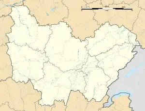 Vauchamps | |
| Coordinates: 47°16′24″N 6°14′28″E / 47.2733°N 6.2411°E | |
| Country | France |
| Region | Bourgogne-Franche-Comté |
| Department | Doubs |
| Arrondissement | Besançon |
| Canton | Baume-les-Dames |
| Commune | Bouclans |
| Area 1 | 2.94 km2 (1.14 sq mi) |
| Population (2019)[1] | 120 |
| • Density | 41/km2 (110/sq mi) |
| Time zone | UTC+01:00 (CET) |
| • Summer (DST) | UTC+02:00 (CEST) |
| Postal code | 25360 |
| Elevation | 395–457 m (1,296–1,499 ft) |
| 1 French Land Register data, which excludes lakes, ponds, glaciers > 1 km2 (0.386 sq mi or 247 acres) and river estuaries. | |
Vauchamps (French pronunciation: [voʃɑ̃]) is a former commune in the Doubs department in the Bourgogne-Franche-Comté region in eastern France. On 1 January 2018, it was merged into the commune of Bouclans.[2]
Geography
Vauchamps lies 9 km (5.6 mi) south of Roulans on a wooded plain. The commune occupies a wooded plain with several small lakes and the Gour, over which there is a bridge in the middle of the village.
Population
| Year | Pop. | ±% |
|---|---|---|
| 1962 | 69 | — |
| 1968 | 77 | +11.6% |
| 1975 | 87 | +13.0% |
| 1982 | 74 | −14.9% |
| 1990 | 102 | +37.8% |
| 1999 | 121 | +18.6% |
| 2008 | 123 | +1.7% |
| 2012 | 130 | +5.7% |
See also
References
- ↑ Téléchargement du fichier d'ensemble des populations légales en 2019, INSEE
- ↑ Arrêté préfectoral 21 September 2017 (in French)
External links
Wikimedia Commons has media related to Vauchamps (Doubs).
- Vauchamps on the regional Web Site (in French)
This article is issued from Wikipedia. The text is licensed under Creative Commons - Attribution - Sharealike. Additional terms may apply for the media files.