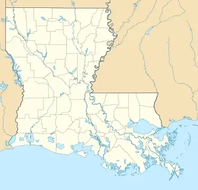
Verret
Verrett, Verrettville | |
|---|---|
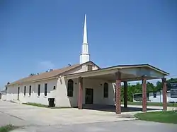 First Baptist Church of Verrettville | |
 Verret  Verret | |
| Coordinates: 29°51′43″N 89°46′47″W / 29.86194°N 89.77972°W | |
| Country | |
| State | |
| Parish | |
| MCD | District E |
| Established | 1871 |
| Elevation | 0.9 m (3 ft) |
| Time zone | UTC−6 (Central) |
| • Summer (DST) | UTC−5 (Central) |
| ZIP code | 70085 |
| Area code | 504 |
| GNIS feature ID | 1628427 |
Verret (/ˈvɜːrɛt/), commonly known as Verrett or Verrettville, is an unincorporated community in St. Bernard Parish, Louisiana, United States.[1] The community was originally established as a freedmen's town by formerly enslaved African Americans.[2]
In 2018, a Louisiana state historical marker was placed at the First Baptist Church of Verrettville in recognition of its significance in addition to the importance of community founder Rev. Samuel Smith.[3]
References
- ↑ "Verret". Geographic Names Information System. United States Geological Survey, United States Department of the Interior. Retrieved August 29, 2021.
- ↑ Hyland, William de Marigny (2020-12-01). History of Verrettville. Bill Hyland's Historical Highlights. Fernández, Anthony. Raymond, Smith. St. Bernard Parish Television.
- ↑ "First Baptist Church in Verret receives a Historical Marker". The St. Bernard News. 2018-01-24. Retrieved 2021-09-30.
Municipalities and communities of St. Bernard Parish, Louisiana, United States | ||
|---|---|---|
| CDPs | 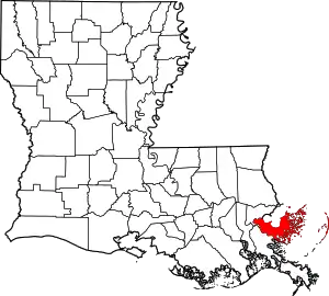 | |
| Other communities | ||
| Ghost towns | ||
This article is issued from Wikipedia. The text is licensed under Creative Commons - Attribution - Sharealike. Additional terms may apply for the media files.