Villers-Bocage | |
|---|---|
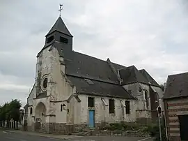 The church in Villers-Bocage | |
 Coat of arms | |
Location of Villers-Bocage | |
 Villers-Bocage  Villers-Bocage | |
| Coordinates: 49°59′52″N 2°19′06″E / 49.9978°N 2.3183°E | |
| Country | France |
| Region | Hauts-de-France |
| Department | Somme |
| Arrondissement | Amiens |
| Canton | Amiens-2 |
| Intercommunality | CC Territoire Nord Picardie |
| Government | |
| • Mayor (2020–2026) | Anne-Sophie Domont[1] |
| Area 1 | 14.17 km2 (5.47 sq mi) |
| Population | 1,459 |
| • Density | 100/km2 (270/sq mi) |
| Time zone | UTC+01:00 (CET) |
| • Summer (DST) | UTC+02:00 (CEST) |
| INSEE/Postal code | 80798 /80260 |
| Elevation | 85–136 m (279–446 ft) (avg. 133 m or 436 ft) |
| 1 French Land Register data, which excludes lakes, ponds, glaciers > 1 km2 (0.386 sq mi or 247 acres) and river estuaries. | |
Villers-Bocage (French pronunciation: [vilɛʁ bɔkaʒ] ⓘ) is a commune in the Somme department in Hauts-de-France in northern France.
Geography
The commune is situated 8 miles (13 km) north of Amiens, on the N25 road.
Population
|
| |||||||||||||||||||||||||||||||||||||||||||||
| Source: EHESS[3] and INSEE (1968-2017)[4] | ||||||||||||||||||||||||||||||||||||||||||||||
See also
References
- ↑ "Répertoire national des élus: les maires". data.gouv.fr, Plateforme ouverte des données publiques françaises (in French). 2 December 2020.
- ↑ "Populations légales 2021". The National Institute of Statistics and Economic Studies. 28 December 2023.
- ↑ Des villages de Cassini aux communes d'aujourd'hui: Commune data sheet Villers-Bocage, EHESS (in French).
- ↑ Population en historique depuis 1968, INSEE
External links
Wikimedia Commons has media related to Villers-Bocage (Somme).
- Website of the commune’s orchestra (in French)
This article is issued from Wikipedia. The text is licensed under Creative Commons - Attribution - Sharealike. Additional terms may apply for the media files.