Höhenkirchen-Siegertsbrunn | |
|---|---|
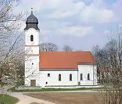 Church of Saint Leonard | |
 Coat of arms | |
Location of Höhenkirchen-Siegertsbrunn within Munich district 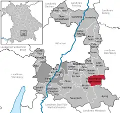 | |
 Höhenkirchen-Siegertsbrunn  Höhenkirchen-Siegertsbrunn | |
| Coordinates: 48°01′N 11°44′E / 48.017°N 11.733°E | |
| Country | Germany |
| State | Bavaria |
| Admin. region | Oberbayern |
| District | Munich |
| Subdivisions | 3 Ortsteile |
| Government | |
| • Mayor (2020–26) | Mindy Konwitschny[1] (SPD) |
| Area | |
| • Total | 15.19 km2 (5.86 sq mi) |
| Elevation | 586 m (1,923 ft) |
| Population (2022-12-31)[2] | |
| • Total | 11,422 |
| • Density | 750/km2 (1,900/sq mi) |
| Time zone | UTC+01:00 (CET) |
| • Summer (DST) | UTC+02:00 (CEST) |
| Postal codes | 85635 |
| Dialling codes | 08102 |
| Vehicle registration | M |
| Website | www.hoehenkirchen-siegertsbrunn.de |
Höhenkirchen-Siegertsbrunn is a municipality in Upper Bavaria, situated south of Munich. It is one of the municipalities with the longest names in Germany, the longest being Hellschen-Heringsand-Unterschaar.
International relations
Twin towns — Sister cities
Höhenkirchen-Siegertsbrunn is twinned with:
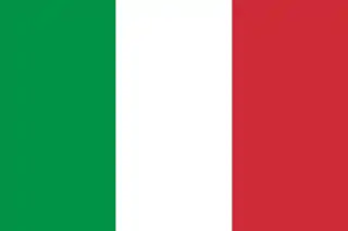 Montemarciano, Italy
References
- ↑ Liste der ersten Bürgermeister/Oberbürgermeister in kreisangehörigen Gemeinden, Bayerisches Landesamt für Statistik, 15 July 2021.
- ↑ Genesis Online-Datenbank des Bayerischen Landesamtes für Statistik Tabelle 12411-003r Fortschreibung des Bevölkerungsstandes: Gemeinden, Stichtag (Einwohnerzahlen auf Grundlage des Zensus 2011)
This article is issued from Wikipedia. The text is licensed under Creative Commons - Attribution - Sharealike. Additional terms may apply for the media files.