Wachtendonk | |
|---|---|
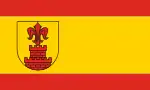 Flag  Coat of arms | |
Location of Wachtendonk within Kleve district 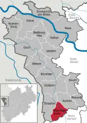 | |
 Wachtendonk 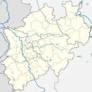 Wachtendonk | |
| Coordinates: 51°24′33″N 6°20′16″E / 51.40917°N 6.33778°E | |
| Country | Germany |
| State | North Rhine-Westphalia |
| Admin. region | Düsseldorf |
| District | Kleve |
| Subdivisions | 2 |
| Government | |
| • Mayor (2020–25) | Paul Robert Hoene[1] |
| Area | |
| • Total | 48.1 km2 (18.6 sq mi) |
| Elevation | 29 m (95 ft) |
| Population (2021-12-31)[2] | |
| • Total | 8,192 |
| • Density | 170/km2 (440/sq mi) |
| Time zone | UTC+01:00 (CET) |
| • Summer (DST) | UTC+02:00 (CEST) |
| Postal codes | 47669 |
| Dialling codes | 0 28 36 |
| Vehicle registration | KLE |
| Website | www.wachtendonk.de |
Wachtendonk at the confluence of Niers River and Nette River is a municipality in the district of Kleve in North Rhine-Westphalia, Germany. It is located west of the Rhine half way between Duisburg and Venlo at the Dutch border. Its name means 'bailiff's Donk'.
Gallery
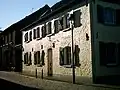 Feldstrasse
 Old Monastery 'Thal Josaphat'
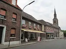 Wankum, church (Sankt Martin Kirche) in the street
References
- ↑ Wahlergebnisse in NRW Kommunalwahlen 2020, Land Nordrhein-Westfalen, accessed 21 June 2021.
- ↑ "Bevölkerung der Gemeinden Nordrhein-Westfalens am 31. Dezember 2021" (in German). Landesbetrieb Information und Technik NRW. Retrieved 20 June 2022.
External links
- Official website
 (in German)
Wikimedia Commons has media related to Wachtendonk.
Towns and municipalities in Kleve (district) | ||
|---|---|---|
Coat of Arms of Kleve district | ||
This article is issued from Wikipedia. The text is licensed under Creative Commons - Attribution - Sharealike. Additional terms may apply for the media files.