Wadrilltal | |
|---|---|
Location of Wadrilltal | |
 Wadrilltal 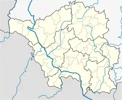 Wadrilltal | |
| Coordinates: 49°35′N 6°53′E / 49.583°N 6.883°E | |
| Country | Germany |
| State | Saarland |
| District | Merzig-Wadern |
| Town | Wadern |
| Area | |
| • Total | 16.35 km2 (6.31 sq mi) |
| Elevation | 322 m (1,056 ft) |
| Population (2021)[1] | |
| • Total | 1,974 |
| • Density | 120/km2 (310/sq mi) |
| Time zone | UTC+01:00 (CET) |
| • Summer (DST) | UTC+02:00 (CEST) |
| Postal codes | 66687 |
| Dialling codes | 06871 |
| Vehicle registration | MZG |
Wadrilltal is a quarter (Stadtteil) of the town Wadern, in Merzig-Wadern district, Saarland, in the south-west of Germany. It is situated on the small river Wadrill. Wadrilltal is known for its large forests and for its hiking trails.
References
- ↑ "Einwohner der Gemeinden und Ortsteile Stand 31.12.2020". Landkreis Goslar. Retrieved 24 September 2021.
External links
This article is issued from Wikipedia. The text is licensed under Creative Commons - Attribution - Sharealike. Additional terms may apply for the media files.