War Eagle, Arkansas
Wareagle, War Eagle Mills | |
|---|---|
 War Eagle Mill | |
 War Eagle, Arkansas Location of War Eagle within Arkansas | |
| Coordinates: 36°16′04″N 93°56′28″W / 36.26778°N 93.94111°W | |
| Country | |
| State | |
| County | Benton |
| Elevation | 359 m (1,178 ft) |
| GNIS feature ID | 78688[1] |
War Eagle is an unincorporated community in Benton County, Arkansas, United States.[1] It is the location of (or is the nearest community to) War Eagle Bridge, which carries CR 98 over War Eagle Creek and is listed on the National Register of Historic Places.[2]
Variant names were "Blackburn Mill", "Wareagle", and "War Eagle Mills".[1] The community takes its name from War Eagle Mill, a local gristmill on War Eagle Creek.[3] A post office called War Eagle Mills was established in 1876, the name was changed to Wareagle in 1894, and the post office closed in 1967.[4]
References
- 1 2 3 4 U.S. Geological Survey Geographic Names Information System: War Eagle, Arkansas
- ↑ "National Register Information System". National Register of Historic Places. National Park Service. March 13, 2009.
- ↑ History of Benton, Washington, Carroll, Madison, Crawford, Franklin, and Sebastian Counties, Arkansas. Higginson Book Company. 1889. p. 120.
- ↑ "Post Offices". Jim Forte Postal History. Retrieved February 4, 2018.
External links
![]() Media related to War Eagle, Arkansas at Wikimedia Commons
Media related to War Eagle, Arkansas at Wikimedia Commons
Municipalities and communities of Benton County, Arkansas, United States | ||
|---|---|---|
| Cities | 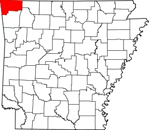 Map of Arkansas highlighting Benton County | |
| Towns | ||
| Townships | ||
| CDPs | ||
| Other communities | ||
| Ghost towns | ||
| Footnotes | ‡This populated place also has portions in an adjacent county or counties Bethel Heights, a former municipality, is now a part of Springdale | |
36°16′04″N 93°56′28″W / 36.26778°N 93.94111°W
This article is issued from Wikipedia. The text is licensed under Creative Commons - Attribution - Sharealike. Additional terms may apply for the media files.