Westbourne | |
|---|---|
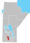
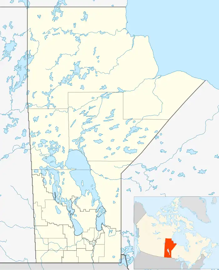 Westbourne Location of Westbourne in Manitoba | |
| Coordinates: 50°7′47″N 98°34′52″W / 50.12972°N 98.58111°W | |
| Country | |
| Province | |
| Region | Central Plains |
| Census Division | No. 8 |
| Government | |
| • MP | Dan Mazer |
| • MLA | Eileen Clarke |
| Time zone | UTC−6 (CST) |
| • Summer (DST) | UTC−5 (CDT) |
| Postal Code | R0H 1P0 |
| Area code | 204 |
| NTS Map | 062J02 |
| GNBC Code | GBDPH |
Westbourne, Manitoba is an unincorporated community northwest of Portage la Prairie, Manitoba, Canada on the Yellowhead Highway. It is part of the Municipality of WestLake – Gladstone. The post office was opened in 1871 as White Mud River and became Westbourne in 1873.
References
- Geographic Names of Manitoba (pg. 292) - the Millennium Bureau of Canada
Division No. 8, Manitoba (Central Manitoba) | ||||
|---|---|---|---|---|
| Towns |
|  | ||
| Villages |
| |||
| Rural municipalities |
| |||
| First Nations | ||||
| Indian reserves |
| |||
| Unincorporated communities | ||||
This article is issued from Wikipedia. The text is licensed under Creative Commons - Attribution - Sharealike. Additional terms may apply for the media files.