| Wicker Branch Tributary to Lanes Creek | |
|---|---|
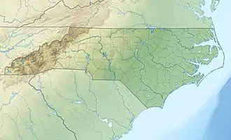 Location of Wicker Branch mouth  Wicker Branch (Lanes Creek tributary) (the United States) | |
| Location | |
| Country | United States |
| State | North Carolina |
| County | Union |
| Physical characteristics | |
| Source | Buck Branch divide |
| • location | pond about 5 miles east-northeast of Alton, North Carolina |
| • coordinates | 34°53′44″N 080°29′02″W / 34.89556°N 80.48389°W[1] |
| • elevation | 638 ft (194 m)[2] |
| Mouth | Lanes Creek |
• location | about 6 miles south of Allens Crossroads, North Carolina |
• coordinates | 34°51′53″N 080°25′12″W / 34.86472°N 80.42000°W[1] |
• elevation | 471 ft (144 m)[2] |
| Length | 5.22 mi (8.40 km)[3] |
| Basin size | 9.36 square miles (24.2 km2)[4] |
| Discharge | |
| • location | Lanes Creek |
| • average | 11.10 cu ft/s (0.314 m3/s) at mouth with Lanes Creek[4] |
| Basin features | |
| Progression | Lanes Creek → Rocky River → Pee Dee River → Winyah Bay → Atlantic Ocean |
| River system | Pee Dee River |
| Tributaries | |
| • left | Mountain Springs Branch |
| • right | Cowpens Branch |
| Bridges | Medlin Road, US 601, Belk Mill Road |
Wicker Branch is a 5.22 mi (8.40 km) long 3rd order tributary to Lanes Creek in Union County, North Carolina.
Course
Wicker Branch rises in a pond about 5 miles east-northeast of Alton, North Carolina. Wicker Branch then flows southeast to meet Lanes Creek about 6 miles south of Allens Crossroads, North Carolina.[2]
Watershed
Wicker Branch drains 9.36 square miles (24.2 km2) of area, receives about 48.4 in/year of precipitation, has a topographic wetness index of 434.25 and is about 38% forested.[4]
References
- 1 2 "GNIS Detail - Wicker Branch". geonames.usgs.gov. US Geological Survey. Retrieved 24 October 2020.
- 1 2 3 "Cedar Branch Topo Map in Union". TopoZone. Locality, LLC. Retrieved 24 October 2020.
- ↑ "ArcGIS Web Application". epa.maps.arcgis.com. US EPA. Retrieved 24 October 2020.
- 1 2 3 "Wicker Branch Watershed Report". US EPA Geoviewer. US EPA. Retrieved 24 October 2020.
This article is issued from Wikipedia. The text is licensed under Creative Commons - Attribution - Sharealike. Additional terms may apply for the media files.