Zhanlan Road Subdistrict
展览路街道 | |
|---|---|
_-_panoramio.jpg.webp) Beijing Exhibition Center within the subdistrict, 2007 | |
 Zhanlan Road Subdistrict  Zhanlan Road Subdistrict | |
| Coordinates: 39°55′53″N 116°20′12″E / 39.93139°N 116.33667°E | |
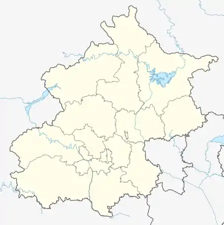
| Country | China |
| Municipality | Beijing |
| District | Xicheng |
| Area | |
| • Total | 5.87 km2 (2.27 sq mi) |
| Population (2020) | |
| • Total | 114,831 |
| • Density | 20,000/km2 (51,000/sq mi) |
| Time zone | UTC+8 (China Standard) |
| Postal code | 100037 |
| Area code | 010 |
Zhanlan Road Subdistrict, or Zhanlanlu Subdistrict (Chinese: 展览路街道; pinyin: Zhǎnlǎnlù Jiēdào) is a subdistrict in the northwest portion of Xicheng District, Beijing, China. In 2020 its population is 114,831.[1]
This subdistrict got its name due to the Beijing Exhibition Center within it.
History
| Time | Status |
|---|---|
| Qing dynasty | Part of Guanwai Ward |
| 1912 | Part of 2nd Inner, 4th Inner, West Suburban and 6th Suburban Districts. |
| 1949 | Part of 2nd, 4th and 16th Districts |
| 1950 | Part of 2nd, 4th and 13th Districts |
| 1952 | Part of Xidan, Xisi and Haidian Districts |
| 1958 | Formally created as Zhanlan Road Subdistrict, as transferred under Xicheng District |
| 1980 | Area south of Baiwangzhuang Avenue and north of Fuwai Avenue were transferred to Fuwai Subdistrict |
| 2004 | Fuwai Subdistrict was incorporated into Zhanlan Road Subdistrict |
Administrative Division
As of 2021, there are a total of 22 communities in the subdistrict:[3]
| Administrative Division Code | Community Name in English | Community Name in Chinese |
|---|---|---|
| 110102009001 | Wenxingjie | 文兴街 |
| 110102009002 | Chaoyang'an | 朝阳庵 |
| 110102009005 | Santa | 三塔 |
| 110102009008 | Xinhuanan | 新华南 |
| 110102009009 | Baiwanzhuangdong | 百万庄东 |
| 110102009011 | BaiwanzhuangXi | 百万庄西 |
| 110102009013 | Chegongzhuang | 车公庄 |
| 110102009014 | Xinhuadong | 新华东 |
| 110102009016 | Xinhuali | 新华里 |
| 110102009017 | Yushuguan | 榆树馆 |
| 110102009020 | Debao | 德宝 |
| 110102009023 | Tuanjie | 团结 |
| 110102009026 | Beiyingfang Xili | 北营房西里 |
| 110102009028 | Beiyingfang Dongli | 北营房东里 |
| 110102009031 | Huangguayuan | 黄瓜园 |
| 110102009032 | Luyuan | 露园 |
| 110102009035 | Fuwaixi | 阜外西 |
| 110102009036 | Hongmaogou | 洪茂沟 |
| 110102009038 | Fuwaidong | 阜外东 |
| 110102009039 | Nanyingfang | 南营房 |
| 110102009041 | Wanmingyuan | 万明园 |
| 110102009042 | Binhe | 滨河 |
| 110102009043 | Kouzhong | 扣钟 |
Landmark
External links
References
- ↑ Zhong guo tong ji nian jian = China statistical yearbook. 2020(zong di 39 qi) 2020(No. 39). Guo jia tong ji ju, 国家统计局. (Di 1 ban ed.). Beijing: Zhong guo tong ji chu ban she. 2020. ISBN 978-7-5037-9225-0. OCLC 1262741013.
{{cite book}}: CS1 maint: others (link) - ↑ Zhong hua ren min gong he guo zheng qu da dian. Bei jing shi juan. Li li guo, Li wan jun, Wu shi min, 李立国., 李万钧., 吴世民. Bei jing: Zhong guo she hui chu ban she. 2013. ISBN 978-7-5087-4058-4. OCLC 910451741.
{{cite book}}: CS1 maint: others (link) - ↑ "2021年统计用区划代码和城乡划分代码". www.stats.gov.cn. Retrieved 2022-09-19.
This article is issued from Wikipedia. The text is licensed under Creative Commons - Attribution - Sharealike. Additional terms may apply for the media files.