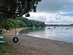
Ōmiha | |
|---|---|
 Ōmiha Bay | |
| Coordinates: 36°48′58″S 175°03′25″E / 36.816°S 175.057°E | |
| Country | New Zealand |
| Region | Auckland Region |
| Ward | Waitematā and Gulf ward |
| Community board | Waiheke Local Board |
| Electorates | |
| Government | |
| • Territorial Authority | Auckland Council |
| Area | |
| • Total | 0.63 km2 (0.24 sq mi) |
| Population (June 2023)[2] | |
| • Total | 570 |
| • Density | 900/km2 (2,300/sq mi) |
Ōmiha is a rural settlement on the southwest coast of Waiheke Island in the Auckland Region of New Zealand.[3] The settlement began when the O'Brien brothers subdivided their farm in 1922, naming it "Omiha Beach Estate".[4] The area is also known as Rocky Bay from the bay to the south.[5] A proposal that the name change to Rocky Bay in 2017 met strong opposition[6] and was rejected.[7] The name Ōmiha, with the macron, became official in 2018.[4]
Demographics
Statistics New Zealand describes Ōmiha as a rural settlement, which covers 0.63 km2 (0.24 sq mi)[1] and had an estimated population of 570 as of June 2023,[2] with a population density of 905 people per km2. Ōmiha is part of the larger Waiheke East statistical area.[8]
| Year | Pop. | ±% p.a. |
|---|---|---|
| 2006 | 342 | — |
| 2013 | 384 | +1.67% |
| 2018 | 492 | +5.08% |
| Source: [9] | ||
Ōmiha had a population of 492 at the 2018 New Zealand census, an increase of 108 people (28.1%) since the 2013 census, and an increase of 150 people (43.9%) since the 2006 census. There were 207 households, comprising 225 males and 261 females, giving a sex ratio of 0.86 males per female, with 72 people (14.6%) aged under 15 years, 60 (12.2%) aged 15 to 29, 243 (49.4%) aged 30 to 64, and 114 (23.2%) aged 65 or older.
Ethnicities were 88.4% European/Pākehā, 11.6% Māori, 9.1% Pacific peoples, 3.7% Asian, and 3.7% other ethnicities. People may identify with more than one ethnicity.
Although some people chose not to answer the census's question about religious affiliation, 65.9% had no religion, 20.1% were Christian, 0.6% were Hindu, 1.2% were Buddhist and 2.4% had other religions.
Of those at least 15 years old, 144 (34.3%) people had a bachelor's or higher degree, and 63 (15.0%) people had no formal qualifications. 75 people (17.9%) earned over $70,000 compared to 17.2% nationally. The employment status of those at least 15 was that 180 (42.9%) people were employed full-time, 63 (15.0%) were part-time, and 6 (1.4%) were unemployed.[9]
Notes
- 1 2 "ArcGIS Web Application". statsnz.maps.arcgis.com. Retrieved 29 July 2022.
- 1 2 "Subnational population estimates (RC, SA2), by age and sex, at 30 June 1996-2023 (2023 boundaries)". Statistics New Zealand. Retrieved 25 October 2023. (regional councils); "Subnational population estimates (TA, SA2), by age and sex, at 30 June 1996-2023 (2023 boundaries)". Statistics New Zealand. Retrieved 25 October 2023. (territorial authorities); "Subnational population estimates (urban rural), by age and sex, at 30 June 1996-2023 (2023 boundaries)". Statistics New Zealand. Retrieved 25 October 2023. (urban areas)
- ↑ Harriss, Gavin (March 2022). Omiha, Auckland (Map). NZ Topo Map.
- 1 2 "Ōmiha". Toitū Te Whenua Land Information New Zealand. Retrieved 31 July 2022.
- ↑ Discover New Zealand:A Wises Guide (9th ed.). 1994. p. 49.
- ↑ Hill, Ben (20 July 2017). "Strong opposition to te reo Maori to English name change for Omiha on Waiheke Island". New Zealand Herald.
- ↑ Davis, Rose (20 January 2018). "Waiheke Island village keeps its Māori name". Stuff.
- ↑ 2018 Census place summary: Waiheke East
- 1 2 "Statistical area 1 dataset for 2018 Census". Statistics New Zealand. March 2020. 7003372, 7003383 and 7003384.