Řendějov | |
|---|---|
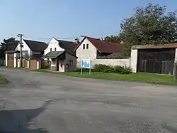 Crossroads in Řendějov | |
 Řendějov Location in the Czech Republic | |
| Coordinates: 49°46′4″N 15°4′50″E / 49.76778°N 15.08056°E | |
| Country | |
| Region | Central Bohemian |
| District | Kutná Hora |
| First mentioned | 1380 |
| Area | |
| • Total | 8.40 km2 (3.24 sq mi) |
| Elevation | 458 m (1,503 ft) |
| Population (2023-01-01)[1] | |
| • Total | 229 |
| • Density | 27/km2 (71/sq mi) |
| Time zone | UTC+1 (CET) |
| • Summer (DST) | UTC+2 (CEST) |
| Postal code | 285 22 |
| Website | www |
Řendějov is a municipality and village in Kutná Hora District in the Central Bohemian Region of the Czech Republic. It has about 200 inhabitants.
Administrative parts
Villages of Jiřice, Nový Samechov and Starý Samechov are administrative parts of Řendějov.
References
Wikimedia Commons has media related to Řendějov.
This article is issued from Wikipedia. The text is licensed under Creative Commons - Attribution - Sharealike. Additional terms may apply for the media files.