Țibleș Mountains, viewed from Dragomirești
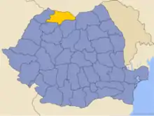
The Țibleș Mountains (Romanian: Munții Țibleș, Hungarian: Cibles or Széples) are a volcanic mountain range located in Maramureș County, in northern Romania. They belong to the Vihorlat-Gutin Area of the Inner Eastern Carpathians.[1]
They are located at the southern border of historical Maramureș region and they cut off the Maramureș valleys from the rest of Romania. The range's highest peak is Bran Peak, at 1,840 m (6,040 ft).[1] The closest town is Dragomirești.
See also

Maramureș County in Romania
References
- 1 2 Ilieș, Marin; Ilieș, Gabriela. "Țibleș Mountains (Romania) Tourist Map" (PDF). www.mountaincartography.org. Retrieved 21 September 2022.
Sources
- Földvary, Gábor Z. (1988). Geology of the Carpathian Region. Singapore: World Scientific Publishing Company. ISBN 9789813103825.
External links
Wikimedia Commons has media related to Țibleș Mountains.
This article is issued from Wikipedia. The text is licensed under Creative Commons - Attribution - Sharealike. Additional terms may apply for the media files.