 | |
|---|---|
| Rijksweg 67 | |
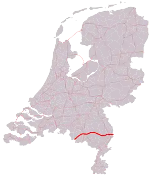
 Location of the A67 motorway | |
| Major junctions | |
| West end | Hapert |
| East end | Venlo |
| Location | |
| Country | Kingdom of the Netherlands |
| Constituent country | Netherlands |
| Provinces | North Brabant |
| Highway system | |

The A67 motorway is a motorway in the Netherlands. It is located in the Dutch provinces of North Brabant and Limburg.
Overview
The road is approximately 75 kilometer in length. The A67 motorway connects the Belgian border (A21/E34 road) near Hapert with Eindhoven and the German border (A40 road) near Venlo. Along the entire stretch of the motorway, the European route E34 travels along the A67. Besides, the section near Eindhoven, between interchanges De Hogt and Leenderheide, is shared with the A2 motorway and European route E25.
In the past, traffic from the Eindhoven area towards the German Autobahn A61 had to take exit 41, and then travel along local roads for approximately 7 kilometers before they reached the border and the start of the German A61. Since 4 April 2012, a connection between the Dutch A73 and the German A61 is in operation (the A74), which gives drivers the possibility to travel between the Dutch A67 and the German A61 without having to leave the motorway.
Exit list
| Province | Municipality | km | mi | Exit | Name | Destinations | Notes |
|---|---|---|---|---|---|---|---|
| North Brabant | Bladel | 0 | 0.0 | — | — | Border with Belgium; this road continues as the Belgian A21; west end of E 34 overlap | |
| 5 | 3.1 | 29 | Hapert | ||||
| Eersel | 10 | 6.2 | 30 | Eersel | |||
| Veldhoven | 15 | 9.3 | 31 | Veldhoven-West | |||
| Eindhoven | 19 | 12 | — | Interchange De Hogt | West end of E 25, A2 and N2 overlap | ||
| 20 | 12 | 32a | High Tech Campus Eindhoven | High Tech Campus | |||
| 22 | 14 | 33 | Waalre | ||||
| 23 | 14 | — | Interchange Leenderheide | East end of E 25, A2 and N2 overlap | |||
| Geldrop-Mierlo | 28 | 17 | 34 | Geldrop | Bogardeind | ||
| Someren | 37 | 23 | 35 | Someren | |||
| Asten | 42 | 26 | 36 | Asten | |||
| Deurne | 50 | 31 | 37 | Liessel | Koeweideweg | ||
| Limburg | Helden | 58 | 36 | 38 | Helden | ||
| Venlo | 65 | 40 | 39 | Sevenum | |||
| 69 | 43 | — | Interchange Zaarderheiken | ||||
| Arcen en Velden | 72 | 45 | 40 | Velden | |||
| Venlo | 74 | 46 | 41 | Venlo | Wisselweg | ||
| — | — | Border with Germany; this road continues as the German A40; east end of E 34 overlap | |||||
1.000 mi = 1.609 km; 1.000 km = 0.621 mi
| |||||||
External links
![]() Media related to Rijksweg 67 at Wikimedia Commons
Media related to Rijksweg 67 at Wikimedia Commons