Abenberg | |
|---|---|
 Coat of arms | |
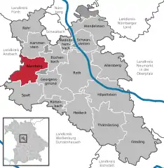
Location of Abenberg within Roth district  | |
 Abenberg  Abenberg | |
| Coordinates: 49°15′N 10°58′E / 49.250°N 10.967°E | |
| Country | Germany |
| State | Bavaria |
| Admin. region | Mittelfranken |
| District | Roth |
| Subdivisions | 7 districts |
| Government | |
| • Mayor (2020–26) | Susanne König[1] (SPD) |
| Area | |
| • Total | 48.39 km2 (18.68 sq mi) |
| Elevation | 414 m (1,358 ft) |
| Population (2022-12-31)[2] | |
| • Total | 5,607 |
| • Density | 120/km2 (300/sq mi) |
| Time zone | UTC+01:00 (CET) |
| • Summer (DST) | UTC+02:00 (CEST) |
| Postal codes | 91183 |
| Dialling codes | 09178 |
| Vehicle registration | RH, HIP |
| Website | www.abenberg.de |
Abenberg (German: [ˈaːbm̩bɛʁk] ⓘ) is a town in the Middle Franconian district of Roth, in Bavaria, Germany. It is situated 9 km west of Roth bei Nürnberg and 25 km southwest of Nuremberg.
Subdivisions
Abenberg has [3] 14 Districts:
|
|

Abenberg
Geography and climate
The city is around 25 kilometers southwest of Nuremberg and ten kilometers west of the district town of Roth, on the northern edge of the Franconian Lake District , broadly seen between the Frankenhöhe in the northwest, Nuremberg in the north and the Franconian Jura in the south and east. The small rivers in the city area drain via the Rednitz/Regnitz to the Main. The spalter hill country rises south of Abenberg.[4]
Sons and daughters of the town
- John Schopper, 27th abbot of monastery Heilsbronn (1529-1540)
- Georg Schwarz (1873-1948), politician, (Bavarian People's Party, Center Party), member of Reichstag and Landtag
References
- ↑ Liste der ersten Bürgermeister/Oberbürgermeister in kreisangehörigen Gemeinden, Bayerisches Landesamt für Statistik, 15 July 2021.
- ↑ Genesis Online-Datenbank des Bayerischen Landesamtes für Statistik Tabelle 12411-003r Fortschreibung des Bevölkerungsstandes: Gemeinden, Stichtag (Einwohnerzahlen auf Grundlage des Zensus 2011)
- ↑ Bayerische-Landesbibliothek-Online.de
- ↑ "BayernAtlas". bayernatlas.de. Retrieved 2023-07-12.
Wikimedia Commons has media related to Abenberg.
This article is issued from Wikipedia. The text is licensed under Creative Commons - Attribution - Sharealike. Additional terms may apply for the media files.