Ahar County
Persian: شهرستان اهر | |
|---|---|
County | |
 Location of Ahar County in East Azerbaijan province | |
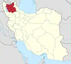 Location of East Azerbaijan province in Iran | |
| Coordinates: 38°32′N 47°09′E / 38.533°N 47.150°E[1] | |
| Country | |
| Province | East Azerbaijan |
| Capital | Ahar |
| Districts | Central, Fandoqlu |
| Population (2016) | |
| • Total | 154,530 |
| Time zone | UTC+3:30 (IRST) |
| Ahar County can be found at GEOnet Names Server, at this link, by opening the Advanced Search box, entering "9205848" in the "Unique Feature Id" form, and clicking on "Search Database". | |
Ahar County (Persian: شهرستان اهر) is in East Azerbaijan province, Iran. Its capital is the city of Ahar.[2]
At the 2006 census, the county's population was 147,781 in 34,067 households.[3] The following census in 2011 counted 150,111 people in 39,715 households.[4] At the 2016 census, the county's population was 154,530 in 46,202 households.[5]
Administrative divisions
The population history and structural changes of Ahar County's administrative divisions over three consecutive censuses are shown in the following table. The latest census shows two districts, nine rural districts, and two cities.[5]
After the 2016 census, Qeshlaq Rural District was separated from the Central District in the establishment of Fandoqlu District, which was divided into two rural districts. At the same time, Hurand District was separated from the county in the establishment of Hurand County, which was divided into two districts of two rural districts each, with the city of Hurand as its capital and only city.[6]
| Administrative Divisions | 2006[3] | 2011[4] | 2016[5] |
|---|---|---|---|
| Central District | 125,253 | 129,022 | 133,829 |
| Azghan RD | 7,100 | 6,314 | 6,204 |
| Bozkosh RD | 4,900 | 5,012 | 4,141 |
| Goyjah Bel RD | 5,056 | 4,269 | 4,307 |
| Owch Hacha RD | 5,286 | 4,670 | 4,407 |
| Qeshlaq RD | 12,028 | 11,448 | 9,833 |
| Varaghan RD | 5,101 | 4,701 | 4,296 |
| Ahar (city) | 85,782 | 92,608 | 100,641 |
| Fandoqlu District1 | |||
| Naqduz RD | |||
| Qeshlaq RD | |||
| Hurand District2 | 22,528 | 21,089 | 20,701 |
| Chahardangeh RD | 8,241 | 7,612 | 7,693 |
| Dikleh RD | 4,017 | 3,602 | 3,090 |
| Dodangeh RD | 6,394 | 5,430 | 5,260 |
| Hurand (city) | 3,876 | 4,445 | 4,658 |
| Total | 147,781 | 150,111 | 154,530 |
| RD: Rural District 1Established after the 2016 census[6] 2Became a part of Hurand County after the 2016 census[6] | |||
Castles
References
- ↑ OpenStreetMap contributors (3 April 2023). "Ahar County" (Map). OpenStreetMap. Retrieved 3 April 2023.
- ↑ Habibi, Hassan (7 July 1369). "Approval of the organization and chain of citizenship of the elements and units of the country divisions of East Azerbaijan province centered on the city of Tabriz". Islamic Parliament Research Center (in Persian). Ministry of Interior, Defense Political Commission of the Government Board. Archived from the original on 4 August 2013. Retrieved 4 December 2023.
- 1 2 "Census of the Islamic Republic of Iran, 1385 (2006)". AMAR (in Persian). The Statistical Center of Iran. p. 03. Archived from the original (Excel) on 20 September 2011. Retrieved 25 September 2022.
- 1 2 "Census of the Islamic Republic of Iran, 1390 (2011)". Syracuse University (in Persian). The Statistical Center of Iran. p. 03. Archived from the original (Excel) on 16 January 2023. Retrieved 19 December 2022.
- 1 2 3 "Census of the Islamic Republic of Iran, 1395 (2016)". AMAR (in Persian). The Statistical Center of Iran. p. 03. Archived from the original (Excel) on 13 November 2020. Retrieved 19 December 2022.
- 1 2 3 Jahangiri, Ishaq (6 November 2018). "Approval letter regarding reforms and divisional changes in East Azerbaijan province". Islamic Council Research Center (in Persian). Ministry of Interior, Council of Ministers. Archived from the original on 6 October 2021. Retrieved 3 December 2023.

| Capital | |||||||||||||||||||||||||||||||
|---|---|---|---|---|---|---|---|---|---|---|---|---|---|---|---|---|---|---|---|---|---|---|---|---|---|---|---|---|---|---|---|
| Districts |
| ||||||||||||||||||||||||||||||