Akyaka District | |
|---|---|
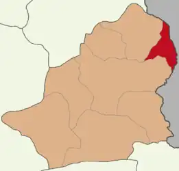 Map showing Akyaka District in Kars Province | |
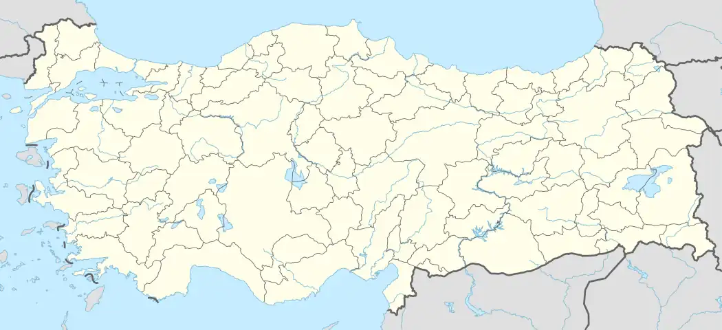 Akyaka District Location in Turkey | |
| Coordinates: 40°45′N 43°38′E / 40.750°N 43.633°E | |
| Country | Turkey |
| Province | Kars |
| Seat | Akyaka |
| Government | |
| • Kaymakam | Selçuk Köksal |
| Area | 417 km2 (161 sq mi) |
| Population (2022) | 9,977 |
| • Density | 24/km2 (62/sq mi) |
| Time zone | TRT (UTC+3) |
| Website | www |
Akyaka District is a district of the Kars Province of Turkey. Its seat is the town of Akyaka.[1] Its area is 417 km2,[2] and its population is 9,977 (2022).[3]
Azerbaijanis of the Qarapapaq tribe form the majority of the District.
Composition
There is one municipality in Akyaka District:[1]
There are 27 villages in Akyaka District:[4]
- Akbulak
- Aslanhane
- Boyuntaş
- Büyükdurduran
- Büyükpirveli
- Camuşlu
- Cebeci
- Çetindurak
- Demirkent
- Duraklı
- Esenyayla
- Geçitköy
- Hacıpiri
- İbişköy
- İncedere
- Kalkankale
- Karahan
- Kayadöven
- Kayaköprü
- Küçükaküzüm
- Küçükdurduran
- Kürekdere
- Şahnalar
- Sulakbahçe
- Süngüderesi
- Üçpınar
- Yerlikavak
References
- 1 2 İlçe Belediyesi, Turkey Civil Administration Departments Inventory. Retrieved 1 March 2023.
- ↑ "İl ve İlçe Yüz ölçümleri". General Directorate of Mapping. Retrieved 1 March 2023.
- ↑ "Address-based population registration system (ADNKS) results dated 31 December 2022, Favorite Reports" (XLS). TÜİK. Retrieved 13 March 2023.
- ↑ Köy, Turkey Civil Administration Departments Inventory. Retrieved 1 March 2023.
Akyaka District in Kars Province of Turkey | |||||||||||||||||||||||||||
|---|---|---|---|---|---|---|---|---|---|---|---|---|---|---|---|---|---|---|---|---|---|---|---|---|---|---|---|
| Districts | 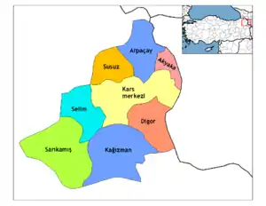 Districts of Kars | ||||||||||||||||||||||||||
| |||||||||||||||||||||||||||
Metropolitan municipalities are bolded. | |||||||||||||||||||||||||||
This article is issued from Wikipedia. The text is licensed under Creative Commons - Attribution - Sharealike. Additional terms may apply for the media files.