Alba, Texas | |
|---|---|
 | |
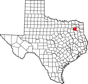
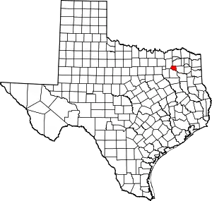
 Location of Alba, Texas | |
 | |
| Coordinates: 32°47′31″N 95°38′4″W / 32.79194°N 95.63444°W | |
| Country | United States |
| State | Texas |
| Counties | Wood, Rains |
| Area | |
| • Total | 1.06 sq mi (2.74 km2) |
| • Land | 1.05 sq mi (2.73 km2) |
| • Water | 0.01 sq mi (0.02 km2) |
| Elevation | 449 ft (137 m) |
| Population (2010) | |
| • Total | 504 |
| • Estimate (2019)[2] | 545 |
| • Density | 517.57/sq mi (199.87/km2) |
| Time zone | UTC-6 (Central (CST)) |
| • Summer (DST) | UTC-5 (CDT) |
| ZIP code | 75410 |
| Area code(s) | 430, 903 |
| FIPS code | 48-01636[3] |
| GNIS feature ID | 1329324[4] |
Alba (/ˈælbə/ AL-bə) is a town located at the intersection of U.S. Highway 69 and Farm To Market Road 17 on the western edge of Wood County, Texas, United States, south of Lake Fork and approximately ten miles west of Quitman. The population was 473 in the 2020 U.S. Census.[5]
History
A gunsmith named Joseph Simpkins was likely the first to settle the area, arriving here with his family from Missouri around 1843. The area was previously alternately known as Albia and Simpkins' Prairie. Theories on how the community got its name differ; one claims it was because the town had been intended for white settlers only while another claims it was named for the son of a railroad official.[6][7]
The Alba Oilfield was discovered just south of Alba in 1848 by F.R. Jackson.[6]
The Missouri, Kansas and Texas Railroad came through Alba in 1881. One of the earliest shipments to Alba is reported to have been a telegraph office and, reportedly one of the first telegraphs received told details of the assassination of President James Garfield.[6] Later that year, Alba also received a post office. It closed briefly in 1882 but reopened that same year.[6]
By 1882, a townsite had been laid out and a number of merchants were opened in the area to serve the influx of railroad-tie cutters; population was 50 by 1884 and 300 by 1896.[6]
A lignite coal deposit was discovered near Alba around 1900 and in 1902 and 1903, the Texas Short Line Railway was constructed to ship coal from Alba and nearby Hoyt to Grand Saline in Van Zandt County. By 1911, five area mines produced about 40,000 tons of coal per month. Population was around 1,500 by this year. Unlike other coal mines in the state, those at Alba were forced to use convict labor, because Alba was a sundown town that banned African Americans and Hispanics from living or working there.[7][8][9]

By 1990, the boundaries of Alba had expanded in to nearby Rains County, and the city had a population of 489, which dropped to 430 in 2000.[6]
Geography
Alba is located at 32°47′31″N 95°38′4″W / 32.79194°N 95.63444°W (32.792069, –95.634532).[10]
According to the United States Census Bureau, the town has a total area of 1.1 square miles (2.9 km2), all land.
It is approximately 60 miles (97 km) northeast of Dallas.[11]
Demographics
| Census | Pop. | Note | %± |
|---|---|---|---|
| 1920 | 1,352 | — | |
| 1930 | 662 | −51.0% | |
| 1940 | 675 | 2.0% | |
| 1950 | 547 | −19.0% | |
| 1960 | 472 | −13.7% | |
| 1970 | 555 | 17.6% | |
| 1980 | 568 | 2.3% | |
| 1990 | 489 | −13.9% | |
| 2000 | 430 | −12.1% | |
| 2010 | 504 | 17.2% | |
| 2019 (est.) | 545 | [2] | 8.1% |
| U.S. Decennial Census[12] | |||
As of the census[3] of 2000, there were 430 people, 196 households, and 118 families residing in the town. The population density was 387.8 inhabitants per square mile (149.7/km2). There were 232 housing units at an average density of 209.2 per square mile (80.8/km2). The racial makeup of the town was 98.60% White, 0.47% African American, 0.47% Native American, and 0.47% from two or more races. Hispanic or Latino of any race were 1.16% of the population.
There were 196 households, out of which 23.5% had children under the age of 18 living with them, 46.9% were married couples living together, 11.7% had a female householder with no husband present, and 39.3% were non-families. 35.7% of all households were made up of individuals, and 20.4% had someone living alone who was 65 years of age or older. The average household size was 2.19 and the average family size was 2.85.
In the town, the population was spread out, with 24.2% under the age of 18, 8.1% from 18 to 24, 19.8% from 25 to 44, 25.6% from 45 to 64, and 22.3% who were 65 years of age or older. The median age was 42 years. For every 100 females, there were 84.5 males. For every 100 females age 18 and over, there were 76.2 males.
The median income for a household in the town was $23,438, and the median income for a family was $29,464. Males had a median income of $28,125 versus $25,278 for females. The per capita income for the town was $13,675. About 11.4% of families and 16.1% of the population were below the poverty line, including 19.4% of those under age 18 and 16.3% of those age 65 or over.
Education
Alba is served by the Alba-Golden Independent School District and home to the Alba-Golden High School Panthers.
Media
During its history, Alba has had two newspapers: the Alba Herald and the Alba Reporter.[6]
Notable people
- Carroll Dawson, assistant coach and general manager in the National Basketball Association
- Leon Payne, "the Blind Balladeer", was a country music singer and songwriter
References
- ↑ "2019 U.S. Gazetteer Files". United States Census Bureau. Retrieved August 7, 2020.
- 1 2 "Population and Housing Unit Estimates". United States Census Bureau. May 24, 2020. Retrieved May 27, 2020.
- 1 2 "U.S. Census website". United States Census Bureau. Retrieved January 31, 2008.
- ↑ "US Board on Geographic Names". United States Geological Survey. October 25, 2007. Retrieved January 31, 2008.
- ↑ "Alba town, Texas - Census Bureau Profile". United States Census Bureau. Retrieved January 6, 2012.
- 1 2 3 4 5 6 7 RACHEL, JENKINS (June 9, 2010). "ALBA, TX". Tshaonline.org. Retrieved November 25, 2016.
- 1 2 "Clipped from the Courier-Gazette". The Daily Courier-Gazette. McKinney, Texas. June 2, 1950. p. 7 – via Newspapers.com.
Alba, Texas was so named because settlers did not permit negroes to live there. Alba means 'white.'
- ↑ Earnest, D. C. (January 14, 1904). "Convict Labor in Mines". The Galveston Daily News. Galveston, Texas. p. 2 – via Newspapers.com.
It must be remembered that the labor situation at Alba and surrounding territory is different from that which prevails at any other lignite or coal mine in the entire State of Texas; this is due to the fact that the citizens of Alba and that community will not permit either negroes or Mexicans to work there. This makes the owners of the lignite mines at Hoyt, Tex., entirely dependent on white labor; whereas at other mines in Texas both negro and Mexican labor is permitted to enjoy the legal right to work.
- ↑ Loewen, James W. (2005). Sundown Towns: A Hidden Dimension of American Racism. New York City: The New Press. pp. 347, 444. ISBN 978-1-62097-454-4.
- ↑ "US Gazetteer files: 2010, 2000, and 1990". United States Census Bureau. February 12, 2011. Retrieved April 23, 2011.
- ↑ "Texas girl, 17, gets 2 life terms in family deaths". Associated Press at San Diego Union-Tribune. January 3, 2009. Retrieved November 28, 2017.
- ↑ "Census of Population and Housing". Census.gov. Retrieved June 4, 2015.

