Altena | |
|---|---|
 Snowy view of Altena near the Boven Merwede | |
 Flag Coat of arms | |
.svg.png.webp) Location in North Brabant | |
| Coordinates: 51°46′N 4°58′E / 51.77°N 4.97°E | |
| Country | Netherlands |
| Province | North Brabant |
| Established | 1 January 2019 |
| Government | |
| • Body | Municipal council |
| • Mayor | Egbert Lichtenberg (CDA) |
| Area | |
| • Total | 226.64 km2 (87.51 sq mi) |
| • Land | 200.63 km2 (77.46 sq mi) |
| • Water | 26.02 km2 (10.05 sq mi) |
| Population (July 2019)[3] | |
| • Total | 55,718 |
| • Density | 250/km2 (640/sq mi) |
| Time zone | UTC+1 (CET) |
| • Summer (DST) | UTC+2 (CEST) |
| Website | gemeentealtena |


.jpg.webp)


.JPG.webp)


Altena is a municipality in the Netherlands, on a river island in the very north of the province of North Brabant, bordering the provinces of Gelderland and South Holland. Nearby cities are Dordrecht in the west, Gorinchem in the north (both in South Holland), and Waalwijk in the south.
Approximately 56,000 people live in an area of about 201 km², making Altena the largest municipality of North Brabant in terms of land area (surpassing Meierijstad).
Geography
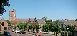
The municipality was formed on 1 January 2019, by the merger of the municipalities of Aalburg, Werkendam, and Woudrichem.[4] Aalburg was only a municipality, Werkendam and Woudrichem are also population centres. Werkendam is the largest town, and the small city of Woudrichem the historical centre of Altena. The village of Almkerk serves as the municipal seat and lies in the middle of the municipality.
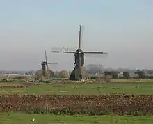
Altena can be characterized as a rural community with population centres mainly concentrated along the surrounding waterways. These waterways are (clockwise, starting in the west): Nieuwe Merwede, Boven Merwede, Afgedamde Maas, Heusdensch Kanaal, Bergsche Maas, and Amer.
De Biesbosch National Park is partially situated in the western part of Altena.
The municipality of Altena is to a large extent identical to the region of the Land van Heusden en Altena. Only De Biesbosch area, existing of the aforementioned De Biesbosch National Park and polders above, falls outside. Waterway Steurgat largely forms the boundary.
Population centres
The municipality of Altena officially has 1 city, 18 villages, and 27 hamlets.[5] However, many villages are the size of a hamlet, and Werkendam and Woudrichem are the size of towns, the latter also having city rights.
- City
- Villages
- Hamlets
- (De) Baan
- Biesheuvel
- Bronkhorst
- Buurtje
- Duizend Morgen
- Eng
- Hagoort
- Hill
- (De) Hoef
- Hoekeinde
- Keizersveer[6]
- Kerkeinde
- Kievitswaard
- Kille
- Korn
- Moleneind
- Oudendijk
- Peerenboom
- Schans
- Spijk
- Stenenheul
- Steurgat
- Uppel
- Vierbannen
- Vijcie
- 't Zand
- Zandwijk
Topography

Dutch topographic map of the municipality of Altena, 2020
Transport
Altena is accessible by bridges and ferries. Important bridges are the northern Merwede Bridge and the southern Keizersveer Bridge. Both bridges are part of motorway A27, which crosses the municipality from north to south.
A car ferry in the very western part connects the city of Dordrecht with Altena.
Nearest railway station is Gorinchem railway station in the municipality of Gorinchem, above Altena on the other side of the Boven Merwede river.
History and religion
Altena is the southernmost part of the Dutch Water Line, an obsolete defensive line, which contains several fortresses in this municipality like Fort Steurgat, Fort aan de Uppelse Dijk, and Fort Giessen, and with Woudrichem as a fortified city.
Contrary to most other North Brabant municipalities, Protestantism is dominant in the Altena municipality, especially the Reformed branch. Church attendance is high, and Christian-oriented political parties receive many votes.
Politics
The municipal council consists of:
| Party | Seats in 2019 |
|---|---|
| Christian Democratic Appeal (CDA) | 8 |
| Altena Lokaal | 6 |
| Reformed Political Party (SGP) | 5 |
| ChristianUnion (CU) [7] | 4 |
| Progressief Altena | 4 |
| People's Party for Freedom and Democracy (VVD) | 3 |
| BURGERSTEM Altena | 1 |
| Total | 31 |
The municipal executive consists of CDA, Altena Lokaal, SGP, and Progressief Lokaal. Mayor has been CDA politician Egbert Lichtenberg (since 9 December 2019).
Sports
Several football clubs have their home base in the municipality:
- Achilles Veen in Veen
- GRC '14 in Giessen
- Kozakken Boys in Werkendam
- VV Almkerk in Almkerk
Each year the 7-Dorpenomloop Aalburg, a prestigious women's road bicycle race, is being held in the southeast corner of Altena (the area of the former municipality of Aalburg, hence the name).
Notable people
- Jan Hendrik van den Berg (1914–2012), psychiatrist
- Erik Braal (born 1971), basketball coach
- Hendrikus Colijn (1869–1944), prime minister
- Leendert Antonie Donker (1899–1956), minister of Justice
- Louwrens Hanedoes (1822–1905), landscape painter
- Hans van Helden (born 1948), speed skater
- Adri van Heteren (born 1951), politician and Christian minister (in Werkendam)
- Cornelis Pieter van den Hoek (1921–2015), resistance fighter (line-crosser)
- Louis van Iersel (1893–1987), American sergeant of World War I
- Ricardo Ippel (born 1990), footballer
- Rebekka Kadijk (born 1979), (beach) volleyball player
- Jan Lohman (born 1959), footballer
- Anton Mussert (1894–1946), civil engineer, political leader and war criminal
- Hans Oerlemans (born 1950), climatologist
- Leo van der Pluym (born 1935), cyclist
- Marieke Lucas Rijneveld (born 1991), writer
- Elsbeth van Rooy-Vink (born 1973), cyclist
- Jan Nico Scholten (born 1932), politician (mayor of Andel, Giessen, and Rijswijk)
- Carola Schouten (born 1977), minister of Agriculture [7]
- Raymond Schouten (born 1985), motorcycle racer
- Kees Stoop (1929–2019), painter
- Edwin Straver (1971–2020), motorcycle racer
- Henri Karel Frederik van Teijn (1839–1892), general and governor
- Gijsbert van Tienhoven (1841–1914), prime minister
- Hermanus Eliza Verschoor (1791–1877), politician (mayor of De Werken en Sleeuwijk)
- Mart Visser (born 1968), fashion designer
- Niels Vorthoren (born 1988), footballer
- Marianne Vos (born 1987), cyclist
References
- ↑ "Kerncijfers wijken en buurten 2020" [Key figures for neighbourhoods 2020]. StatLine (in Dutch). CBS. 24 July 2020. Retrieved 19 September 2020.
- ↑ AlleCijfers.nl
- ↑ "Bevolkingsontwikkeling; regio per maand" [Population growth; regions per month]. CBS Statline (in Dutch). CBS. 1 January 2021. Retrieved 2 January 2022.
- ↑ "Gemeentelijke indeling op 1 januari 2019". CBS (in Dutch). Retrieved 30 November 2019.
- ↑ Altena, Plaatsengids.nl
- ↑ Keizersveer is partially situated in the municipality of Geertruidenberg.
- 1 2 Carola Schouten's younger sister Marjan van der Meij-Schouten is a member of the municipal council, like her older sister on behalf of the ChristianUnion.
External links
 Media related to Altena (Netherlands) at Wikimedia Commons
- Official website

