| Alturas Lake | |
|---|---|
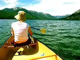
 Paddling on Alturas Lake | |
 Alturas Lake  Alturas Lake | |
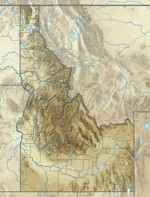
| Location | Blaine County, Idaho |
| Coordinates | 43°54′49″N 114°51′38″W / 43.913517°N 114.860569°W |
| Type | Glacial |
| Primary inflows | Alturas Lake Creek |
| Primary outflows | Alturas Lake Creek to Salmon River |
| Basin countries | United States |
| Max. length | 1.95 mi (3.14 km) |
| Max. width | 0.80 mi (1.29 km) |
| Surface elevation | 7,016 ft (2,138 m) |
Alturas Lake is an alpine lake in Blaine County, Idaho, United States, in the Sawtooth Valley in the Sawtooth National Recreation Area. The lake is approximately 21 miles (34 km) south of Stanley and 30 miles (48 km) northwest of Ketchum. Alturas Lake can be accessed from State Highway 75 via Sawtooth National Forest road 205.[1]
In the southern section of the Sawtooth Valley, Alturas Lake is the second largest lake in Sawtooth National Recreation Area and has easy access around its northern shore, several campgrounds, and private camps. Leah Lake and Logjam Lake are upstream of Alturas Lake.
The lake took its name from the now-defunct Alturas County, Idaho.[2]
See also
References
- ↑ Sawtooth National Forest. "Sawtooth National Forest" [map].1:126,720, 1"=2 miles. Twin Falls, Idaho: Sawtooth National Forest, United States Forest Service, 1998.
- ↑ Rees, John E. (1918). Idaho Chronology, Nomenclature, Bibliography. W.B. Conkey Company. p. 52.
External links
This article is issued from Wikipedia. The text is licensed under Creative Commons - Attribution - Sharealike. Additional terms may apply for the media files.