| Amisk (Beaver) Lake | |
|---|---|
 Detail of David Thompson's 1814 map of Amisk Lake | |
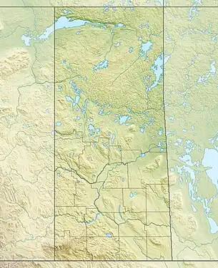
 Amisk (Beaver) Lake Location in Saskatchewan  Amisk (Beaver) Lake Amisk (Beaver) Lake (Canada) | |
| Location | Saskatchewan |
| Coordinates | 54°34′N 102°14′W / 54.567°N 102.233°W |
| Lake type | Glacial lake |
| Primary inflows | Sturgeon-Weir River (West Weir)[1] |
| Primary outflows | Sturgeon-Weir River (South Weir)[1] |
| Basin countries | Canada |
| Surface area | 45,307.5 ha (111,957 acres) |
| Surface elevation | 294 m (965 ft) |
| Islands |
|
| Settlements | Denare Beach |
| References | [2] |

Amisk Lake[3] is a lake in the east-central part of the Canadian province of Saskatchewan, about 22 kilometres (14 mi) south-west of Flin Flon, Manitoba. 'Amisk' means beaver in Cree.[1] Saskatchewan Highway 167 provides road access. Denare Beach, the largest settlement, is located at the north-east corner of the lake.
Forts
Amisk Lake is along the course of the Sturgeon-Weir River,[4] an important part of the canoe route from eastern Canada to the rich Lake Athabasca country. There was an independent trading post on Amisk Lake (Beaver Lake) in 1775 and a Hudson's Bay Company trading post in 1776.[5]
Frobisher-Henry Fort
In June 1775 Alexander Henry the elder left Montreal with 16 canoes and goods worth £3,000. On Lake Winnipeg he was joined by Peter Pond, Joseph Frobisher, and Thomas Frobisher. From the new Hudson's Bay Company post at Cumberland Lake Henry and the two Frobishers went north up the Sturgeon-Weir hoping to reach Frog Portage where Thomas had traded successfully the previous year. They crossed Amisk Lake on the first of November and the next morning it was frozen over. Since there was good fishing they stopped at the mouth of the West Weir and built a fort.[1] On the first of January Henry set out on foot and spent three months visiting the Indians. Next spring they went north to Frog Portage and were successful in trade. Joseph Frobisher maintained the post of Amisk Lake until it was abandoned in 1778.
Amisk Lake Recreation Site
Amisk Lake Recreation Site (54°41′04″N 102°04′38″W / 54.6845°N 102.0773°W)[6] is a provincial recreation site on the eastern shore of Amisk Lake. The park is divided into two sections. The Sand Beach campground is located at the south-east corner of the lake and has a campground with 12 campsites and lake access.[7] At the north-eastern corner of the lake, just north of Denare Beach, is Sawmill Bay Campground. Sawmill Bay also has lake access and includes 27 campsites. Both sites are accessed from Highway 167.[8][9]
Fish Species
The fish species include walleye, yellow perch, northern pike, lake trout, lake whitefish, cisco, white sucker, longnose sucker, and burbot.[10][11]
See also
References
- 1 2 3 4 5 Marchildon, Greg; Robinson (Sid) (2002). Canoeing the Churchill A Practical Guide to the Historic Voyageur Highway. Regina: University of Regina. pp. 353–372. ISBN 0-88977-148-0.
- ↑ Atlas of Canada. "Rivers in Canada". Archived from the original on 10 April 2007. Retrieved 17 March 2015.
- ↑ "Amisk Lake". Canadian Geographical Names Database. Government of Canada. Retrieved 18 January 2023.
- ↑ "Sturgeon-Weir River". Retrieved 18 February 2013.
- ↑ "ENCYCLOPEDIA OF SASKATCHEWAN (list of forts in Northern Saskatchewan)". Retrieved 18 February 2013.
- ↑ "Amisk Lake Recreation Site". Canadian Geographical Names Database. Government of Canada. Retrieved 18 January 2023.
- ↑ "Sand Beach Campground". Tourism Saskatchewan. Government of Saskatchewan. Retrieved 18 January 2023.
- ↑ "Sawmill Bay Campground – Amisk Lake Recreation Site". BRMB. Mussio Ventures Ltd. Retrieved 18 January 2023.
- ↑ "Sawmill Bay Campground". Tourism Saskatchewan. Government of Saskatchewan. Retrieved 18 January 2023.
- ↑ "Amisk Lake". Angler's Atlas. Angler's Atlas. Retrieved 18 January 2023.
- ↑ "Amisk Lake". Fishbrain. Fishbrain. Retrieved 18 January 2023.