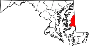
Andersontown, Maryland | |
|---|---|
Populated place | |
 Andersontown, Maryland  Andersontown, Maryland | |
| Coordinates: 38°50′13″N 75°46′51″W / 38.836933°N 75.780752°W | |
| Country | United States |
| State | Maryland |
| County | Caroline |
| Elevation | 52 ft (16 m) |
| GNIS feature ID | 589643[1] |
Andersontown is a populated place on Maryland's Eastern Shore in Caroline County, Maryland, United States.[2] It is situated near the Delaware line, centered on the intersection of Andersontown Road and Maryland Route 404.
History
One of the first mentions of Andersontown is the Andersontown Post office on the 1875 Map of Caroline County.[3][4] On the 1897 Map of Caroline County, It is referred to as Andersontown.[5]
References
- ↑ U.S. Geological Survey Geographic Names Information System: Andersontown
- ↑ U.S. Geological Survey Geographic Names Information System: Andersontown, Maryland
- ↑ Isler, John B (1875). "Map of Caroline County Maryland" (Map). Map of Caroline County, Maryland. 1:42,000. Caroline County.
- ↑ "Andersontown Post Office". Geographic Names Information System. United States Geological Survey, United States Department of the Interior.
- ↑ 1897 Saulsbury Map of Caroline County, Maryland (Map). 1897.
Wikimedia Commons has media related to Andersontown, Maryland.
This article is issued from Wikipedia. The text is licensed under Creative Commons - Attribution - Sharealike. Additional terms may apply for the media files.
