Antonivka
Антонівка Antoniówka | |
|---|---|
 Antonivka  Antonivka | |
| Coordinates: 49°16′27″N 24°11′23″E / 49.27417°N 24.18972°E | |
| Country | |
| Oblast | |
| Raion | Stryi Raion |
| Area | |
| • Total | 1.37 km2 (0.53 sq mi) |
| Elevation /(average value of) | 256 m (840 ft) |
| Population (2001) | |
| • Total | 545 |
| • Density | 400/km2 (1,000/sq mi) |
| Time zone | UTC+2 (EET) |
| • Summer (DST) | UTC+3 (EEST) |
| Postal code | 81776 |
| Area code | +380 3239 |
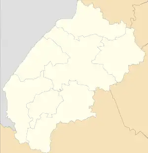
Antonivka (Ukrainian: Антонівка, Polish: Antoniówka) is a village (selo) in Stryi Raion, Lviv Oblast, in western Ukraine. It belongs to Zhuravne settlement hromada, one of the hromadas of Ukraine.[1]
History
Antonivka was mentioned as Jajkowce in the 16th century. The name is derived from the patronymic Polish name Jajko / Jejko, which jajko means egg, (Ukrainian: Яйце).[2] Later, it was renamed Jajkowze (Яйковцӗ) or Jajkiwzi (Яйківці) in Ukrainian.
During the First Partition of Poland in 1772, the village became part of the new Kingdom of Galicia and Lodomeria of the Habsburg monarchy. In 1900, the Jajkowce parish had 84 houses with 548 inhabitants, of which 504 were Ruthenian speakers, 44 were Polish speakers, 485 were Greek-Catholics, 44 were Roman-Catholics, and 19 were Jews.[3]
During World War II, Antonivka first belonged to the Soviet Union and from 1941 to the General Government, from 1945 again to the Ukrainian SSR. Shortly afterward, Most Poles left the village in 1946.[4]
Until 18 July 2020, Antonivka belonged to Zhydachiv Raion. The raion was abolished in July 2020 as part of the administrative reform of Ukraine, which reduced the number of raions of Lviv Oblast to seven. The area of Zhydachiv Raion was merged into Stryi Raion.[5][6]
Demographics
According to the 2001 population census, 545 people lived in the village.[7] The linguistic composition of the population of Antonivka was as follows:[8]
| Language | Percentage |
|---|---|
| Ukrainian | 99.08 % |
| Russian | 0.55 % |
| Moldovan (Romanian) | 0.18 % |
Notes
- ↑ "Журавненская громада" (in Russian). Портал об'єднаних громад України.
- ↑ Anna Czapla (2011). Nazwy miejscowości historycznej ziemi lwowskiej [Die Namen der Ortschaften des historischen Lembergen Lands] (in Polish). Lublin: Towarzystwo Naukowe Katolickiego Uniwersytetu Lubelskiego Jana Pawła II. p. 87. ISBN 978-83-7306-542-0.
- ↑ Ludwig Patryn (Hrsg.): Gemeindelexikon der im Reichsrate vertretenen Königreiche und Länder, bearbeitet auf Grund der Ergebnisse der Volkszählung vom 31. Dezember 1900, XII. Galizien. Wien 1907
- ↑ Grzegorz Rąkowski (2013). Ukraińskie Karpaty i Podkarpacie, część zachodnia. Przewodnik krajoznawczo-historyczny (in Polish). Pruszków: Oficyna Wydawnicza “Rewasz”. p. 293. ISBN 978-83-62460-31-1.
- ↑ "Про утворення та ліквідацію районів. Постанова Верховної Ради України № 807-ІХ". Голос України (in Ukrainian). 2020-07-18. Retrieved 2020-10-03.
- ↑ "Нові райони: карти + склад" (in Ukrainian). Міністерство розвитку громад та територій України.
- ↑ "Населення населених пунктів Львівської області за даними перепису 2001 року". Archived from the original on 3 September 2017. Retrieved 17 May 2013.
- ↑ "Розподіл населення за рідною мовою, Львівська область". Archived from the original on 5 March 2016. Retrieved 20 February 2022.