Ap Lei Chau Bridge 鴨脷洲大橋 | |
|---|---|
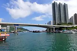
 Ap Lei Chau Bridge viewed from the north. Jumbo Kingdom is visible underneath the central span and Ocean Park in the distance. | |
| Coordinates | 22°14′45″N 114°09′35″E / 22.245877°N 114.159704°E |
| Carries | Vehicles, pedestrians |
| Crosses | Aberdeen Channel |
| Locale | Ap Lei Chau and Aberdeen, Hong Kong |
| Characteristics | |
| Design | Box girder bridge |
| Total length | 230 m (750 ft) |
| Clearance below | 14 m (46 ft) |
| History | |
| Construction start | 1977 (first bridge) |
| Construction cost | HK$64,000,000 |
| Opened | 28 March 1980 (first bridge) 28 July 1994 (duplicate bridge) |
| Statistics | |
| Toll | Free of charge |
| Location | |
| Ap Lei Chau Bridge | |||||||||
|---|---|---|---|---|---|---|---|---|---|
| Traditional Chinese | 鴨脷洲大橋 | ||||||||
| |||||||||
Ap Lei Chau Bridge is a highway bridge in Hong Kong connecting the island of Ap Lei Chau (Aberdeen Island) to the community of Aberdeen on Hong Kong Island.
First bridge
Completed in April 1977, the first bridge had one lane of traffic in each direction. It is a double-cantilever, prestressed-concrete bridge, with a 115 metres (377 ft) main span, two 60 metres (200 ft) side spans, and associated ramps. Maunsell & Partners were the bridge consultants.[1]
Peter Hines was the resident engineer of the bridge. During the construction, he realised that the pre-stressed cantilevers of the bridge would not be able to meet in the centre, which needed an "emergency raise".[2]
Second bridge
Construction of the twin Second Ap Lei Chau Bridge on the north side of the first bridge was started in May 1991 and completed in July 1994 to provide two traffic lanes in each direction.[3][4] Both sides of the bridge have pavements for pedestrian use.
Legislators approved funding for the Second Ap Lei Chau Bridge on 1 May 1991.[5] It opened on 28 July 1994.[6] The first person to drive across it was Kwong Hon-sang, Director of Highways, officiating at the opening ceremony.[6]
The two bridges are Ap Lei Chau's only road links with Hong Kong Island. There is a railway bridge, the Aberdeen Channel Bridge, opened on 28 December 2016 as part of the MTR's South Island line.
See also
References
- ↑ Beanz means Hines / Peter Hines — the worldwide civil engineer ISBN 978-1-71-456394-4 page 14.
- ↑ Obituaries, Telegraph (25 January 2021). "Peter Hines, civil engineer who worked on large-scale projects around the world – obituary". The Telegraph. ISSN 0307-1235. Retrieved 17 April 2023.
- ↑ 景點 [Attractions] (in Chinese). Apleichau Promotion of Tourism Association. Retrieved 13 May 2015.
- ↑ "Roads in Hong Kong Island". Hong Kong Highways Department. Retrieved 13 May 2015.
- ↑ Lau, Jeremy (7 March 1992). "Go-ahead for bridge plan". South China Morning Post. p. 5.
- 1 2 Ball, Steve (27 July 1994). "New bridge prepares to take the strain". South China Morning Post. p. 3.