| Bécancour Lake | |
|---|---|
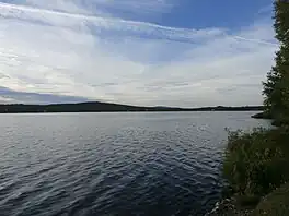
 Lake Bécancour seen from the south shore to the north | |
 Bécancour Lake | |
| Coordinates | 46°04′17″N 71°14′31″W / 46.07133°N 71.24184°W |
| Primary outflows | Bécancour River |
| Basin countries | Canada |
| Surface area | 0.973 kilometres (0.60 mi) |
| Average depth | 3.4 metres (11 ft) |
| Surface elevation | 402 metres (1,319 ft) |
The Lake Bécancour is a lake located in the municipality of Thetford Mines in the administrative region of Chaudière-Appalaches, in Quebec, in Canada. It is the source of the Bécancour River, which flows through the Centre-du-Québec administrative region and joins the St. Lawrence River.
Geography
Its area is approximately 0.973 kilometres (0.60 mi), its altitude of 335 metres (1,099 ft) and its maximum depth is 3.4 meters (11 ft).[1]
Toponymy
The toponym "lac Bécancour" was made official on December 5, 1968, at the Commission de toponymie du Québec.[2]
References
This article is issued from Wikipedia. The text is licensed under Creative Commons - Attribution - Sharealike. Additional terms may apply for the media files.