| Baffle | |
|---|---|
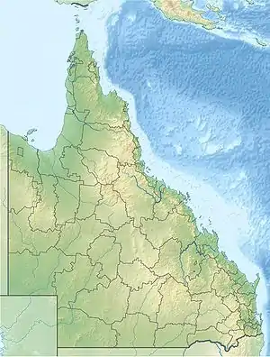 Location of Baffle Creek river mouth in Queensland | |
| Etymology | Baffle (verb)[1] |
| Location | |
| Country | Australia |
| State | Queensland |
| Region | Central Queensland |
| Physical characteristics | |
| Source | Great Dividing Range |
| • location | Arthurs Seat |
| • coordinates | 24°11′13″S 151°38′22″E / 24.18694°S 151.63944°E |
| • elevation | 282 m (925 ft) |
| Mouth | Mouth of Baffle Creek Conservation Park |
• location | Coral Sea, Australia |
• coordinates | 24°29′55″S 152°03′04″E / 24.49861°S 152.05111°E |
• elevation | 0 m (0 ft) |
| Length | 124 km (77 mi) |
| Basin size | 2,541.2 km2 (981.2 sq mi)[2] |
| Discharge | |
| • location | Near mouth |
| • average | 9.75 m3/s (308 GL/a)[2] |
| Basin features | |
| Tributaries | |
| • left | Island Creek (Queensland), Euleilah Creek |
| • right | Granite Creek (Queensland), Three Mile Creek (Queensland), Scrubby Creek, Grevillea Creek |
| Islands | Grants Island; Long Island |
| [3] | |
The Baffle Creek is a creek in Central Queensland, Australia.
Course and features
The Baffle Creek rises near Arthurs Seat in the Eurimbula State Forest and just south of the Eurimbula National Park in the Great Dividing Range. The 124-kilometre (77 mi) creek flows initially southward, hemmed to the west by the Westwood Range and to the east by Mount Dromedary. The creek continues south crossed by the Bruce Highway just east of Miriam Vale and then turns south east forming braided channels near Sonoma and hemmed to the east by the Gwynne Range resulting in the formation of one named island, Grants Island. It then is crossed by the Bruce Highway again and turns east under Mount Maria then north and flows through the Mouth of Baffle Creek Conservation Park and finally discharges into the Coral Sea south of Rules Beach and northeast of Winfield. At its mouth the creek again forms an anabranch around Long Island.[3]
The catchment area of the creek occupies an 4,084 square kilometres (1,577 sq mi) of which an area of 134 square kilometres (52 sq mi) is composed of estuarine wetlands.[4]
Etymology
The creek was named in the 1850s by the pastoralist and politician, William Henry Walsh, during an expedition led by him to track an Aboriginal raiding party into the bush. The footprints of the raiders disappeared in the dense bush along the creek banks leading the party unable to follow them further and leading Walsh to name the creek as Baffle Creek.[1]
See also
References
- 1 2 "Baffle Creek (entry 1219)". Queensland Place Names. Queensland Government. Retrieved 21 June 2015.
- 1 2 "East Coastal Watersheds".
- 1 2 "Map of Baffle Creek Qld". Bonzle Digital Atlas of Australia. Retrieved 21 June 2015.
- ↑ "Baffle Creek drainage basin". WetlandInfo. Queensland Government. Retrieved 21 June 2015.
Rivers of Queensland | |||||||||||||||
|---|---|---|---|---|---|---|---|---|---|---|---|---|---|---|---|
| |||||||||||||||
| |||||||||||||||
| |||||||||||||||
| |||||||||||||||
| |||||||||||||||
| |||||||||||||||