Bankouale بنكوالي | |
|---|---|
Town | |
 | |
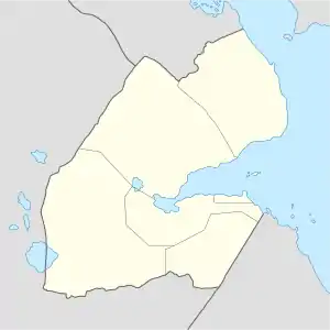 Bankouale بنكوالي Location in Djibouti | |
| Coordinates: 11°49′N 42°40′E / 11.817°N 42.667°E | |
| Country | |
| Region | Tadjoura |
| Elevation | 640 m (2,100 ft) |
Bankouale (Arabic: بنكوالي) is a town in Tadjoura region of Djibouti. One of the distinctive features of Bankouale countryside is the widespread growing of vegetables. In the meantime there are also first approaches to establish gentle tourism.
Climate
Bankouale has a hot arid climate (BWh) by the Köppen-Geiger system.
| Climate data for Bankouale | |||||||||||||
|---|---|---|---|---|---|---|---|---|---|---|---|---|---|
| Month | Jan | Feb | Mar | Apr | May | Jun | Jul | Aug | Sep | Oct | Nov | Dec | Year |
| Mean daily maximum °C (°F) | 25.0 (77.0) |
25.2 (77.4) |
27.2 (81.0) |
29.4 (84.9) |
32.9 (91.2) |
36.5 (97.7) |
36.9 (98.4) |
35.9 (96.6) |
34.0 (93.2) |
30.1 (86.2) |
27.2 (81.0) |
25.5 (77.9) |
30.5 (86.9) |
| Mean daily minimum °C (°F) | 16.0 (60.8) |
17.0 (62.6) |
18.3 (64.9) |
20.5 (68.9) |
23.2 (73.8) |
26.5 (79.7) |
25.6 (78.1) |
25.0 (77.0) |
25.0 (77.0) |
20.6 (69.1) |
18.1 (64.6) |
16.7 (62.1) |
21.0 (69.9) |
| Average rainfall mm (inches) | 30 (1.2) |
27 (1.1) |
18 (0.7) |
25 (1.0) |
10 (0.4) |
4 (0.2) |
16 (0.6) |
30 (1.2) |
29 (1.1) |
11 (0.4) |
38 (1.5) |
23 (0.9) |
261 (10.3) |
| Source: Climate-Data.org, altitude: 640 metres or 2,100 feet[1] | |||||||||||||
References
- ↑ "Climate: Bankouale - Climate graph, Temperature graph, Climate table". Climate-Data.org. Retrieved 6 September 2017.
External links
This article is issued from Wikipedia. The text is licensed under Creative Commons - Attribution - Sharealike. Additional terms may apply for the media files.