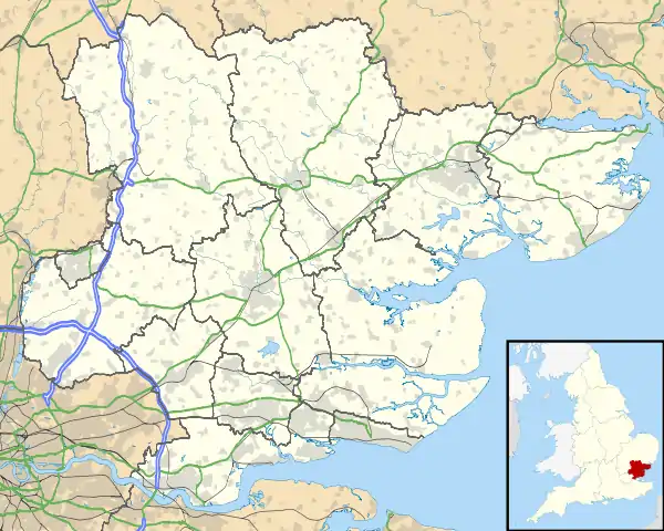
| Berners Roding | |
|---|---|
 All Saints Church, Berners Roding | |
 Berners Roding Location within Essex | |
| OS grid reference | TL603099 |
| Civil parish | |
| District | |
| Shire county | |
| Region | |
| Country | England |
| Sovereign state | United Kingdom |
| Post town | Ongar |
| Postcode district | CM5 |
| Police | Essex |
| Fire | Essex |
| Ambulance | East of England |
Berners Roding (pronounced Barnish)[1] is a village and former civil parish, now in the parish of Abbess, Beauchamp and Berners Roding and the Epping Forest District of Essex, England. The village is included in the eight hamlets and villages called The Rodings. Berners Roding is 6 miles (10 km) west from the county town of Chelmsford. In 1931 the parish had a population of 81.[2]
History

According to A Dictionary of British Place Names, Roding derives from "Rodinges" as is listed in the Domesday Book and recorded earlier as such at c.1050.[3] 'Berners' Roding is not listed in Domesday.
An alternative traditional name for the village, manor, and previous parish, was 'Berners Roothing'. It was in the Hundred of Dunmow. The parish church was appropriated to the monastery of St Leonard, at Bow in Middlesex. The daughter of Sir James Berners, Juliana Berners of the Order of Saint Benedict, writer on heraldry, hawking and hunting, and prioress of the Priory of St Mary of Sopwell, was born in the parish.[4][5]
In the 19th century Berners Roding was in the Dunmow Union—poor relief provision set up under the Poor Law Amendment Act 1834 —and part of the Rural Deanery of Roding. The registers of the church of All Saints' (deconsecrated in 1985 and privately owned) date to 1538. The 1848 living was a perpetual curracy, held by the rector of Margaret Roothing, and in the gift or donative of the lord of the manor. In 1882 the living was in the gift of a Colonel Bramston, and held by the rector of Willingale Doe, part of today's Willingale, where the children of Berners Roding attended school. In 1848 Berners Roothing parish land of 1,030 acres (4.2 km2) supported a population of 103; in 1882, 1,050 acres (4.2 km2) supported 86. Crops grown at the time were chiefly wheat, barley and beans, on a heavy soil with a clay subsoil. Parish occupations included three farmers in 1848, and two in 1882.[4][5]

On 1 April 1946 the parish was abolished to form "Abbess Beauchamp and Berners Roding".[6][7]
Berners Roding's unlisted All Saints Church dates to at least the 14th century, with some remnants dating to the 12th. It was deconsecrated in 1985. It, and its graveyard, is in a state of neglect and decay.[8][9][10]
References
- ↑ Hadfield, J. (1970). The Shell Guide to England. London: Michael Joseph.
- ↑ "Population statistics Berners Roding AP/CP through time". A Vision of Britain through Time. Retrieved 30 June 2023.
- ↑ Mills, Anthony David (2003); A Dictionary of British Place Names, Oxford University Press, revised edition (2011), p.392. ISBN 019960908X
- 1 2 White's Directory of Essex 1848
- 1 2 Kelly's Directory of Essex 1882 pp.245-247
- ↑ "Relationships and changes Berners Roding AP/CP through time". A Vision of Britain through Time. Retrieved 30 June 2023.
- ↑ "Abbess, Beauchamp and Berners Roding" Archived 8 February 2018 at the Wayback Machine, Abbess, Beauchamp and Berners Roding Parish Council. Retrieved 10 February 2018
- ↑ "Berners Roding", British History Online, quoting from An Inventory of the Historical Monuments in Essex, Volume 2, Central and South west (London, 1921), pp.14-15. Retrieved 30 January 2019
- ↑ "History of All Saint's church", The parish of High Ongar. Retrieved 30 January 2019
- ↑ "All Saints, Berners Roding", Essex Churches. Retrieved 30 January 2019
External links
 Media related to Berners Roding at Wikimedia Commons
- Abbess, Beauchamp and Berners Roding Parish Council Archived 8 February 2018 at the Wayback Machine official website including Berners Roding description. Retrieved 10 February 2018
- "Collapsing Essex Church & Prisoner of War Camp", video of derelict All Saints Church at Berners Roding