Bletherston
| |
|---|---|
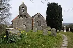
 St Mary's Church, Bletherston | |
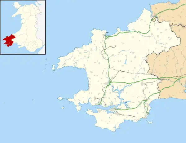
 Bletherston Location within Pembrokeshire | |
| Community | |
| Principal area | |
| Country | Wales |
| Sovereign state | United Kingdom |
| Police | Dyfed-Powys |
| Fire | Mid and West Wales |
| Ambulance | Welsh |
| UK Parliament | |
| Senedd Cymru – Welsh Parliament | |
Bletherston (Welsh: Trefelen) is a small settlement and parish in Pembrokeshire, Wales. It is in the middle of eastern Pembrokeshire, 6 miles (9.7 km) north of Narberth and 8 miles (13 km) northeast of Haverfordwest. The parish includes the village of Penffordd. Together with the parishes of Llys y Fran and New Moat, it constitutes the community of New Moat.
Name
The English placename appears to mean Bleddri's farm: Bleddri is a Welsh name. The Welsh placename Trefelen means "yellow farm".[1]
Parish history
The church of St Mary, in the centre of the village, is a grade II* listed building, parts of which may be 12th century, but have been added to or altered since.[2][3]
The parish,[4] which was noted on a map of 1583,[5] is in the north-west portion of the hundred of Dungleddy which George Owen in 1602 placed south of the Pembrokeshire language frontier. However, as part of the church lands to the north of the Afon Syfynwy, Owen said it was bilingual, and in modern times it has been predominantly Welsh-speaking. The percentage of Welsh language speakers was 97 (1891): 85 (1931): 50 (1971).
The parish had an area of 970 Ha.
According to Lewis's Topographical dictionary of 1844, the population was 371.[6] Its census populations were: 235 (1801): 320 (1851): 235 (1901): 132 (1951): 84 (1981).
References
- ↑ Charles, B. G., The Placenames of Pembrokeshire, National Library of Wales, Aberystwyth, 1992, ISBN 0-907158-58-7, p 400
- ↑ "Church of Saint Mary, New Moat". British Listed Buildings. Retrieved 29 December 2013.
- ↑ Cadw. "Church of St Mary (Grade II*) (6046)". National Historic Assets of Wales. Retrieved 8 August 2019.
- ↑ "GENUKI: parish map 79: Bletherston". Retrieved 8 August 2019.
- ↑ "Penbrok comitat". British Library. Retrieved 8 August 2019.
- ↑ "GENUKI: Bletherston". Retrieved 8 August 2019.
External links