| Bobieding Western Australia | |
|---|---|
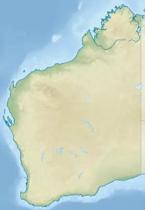
Bobieding is situated on the western side of the Dampier Peninsula, north of Broome. | |
 Bobieding | |
| Coordinates | 16°58′28″S 122°38′04″E / 16.9743831°S 122.6345336°E |
| Postcode(s) | 6725 |
| Time zone | AWST (UTC+8) |
| Location | 120 km (75 mi) north of Broome, Western Australia |
| LGA(s) | Shire of Broome |
| State electorate(s) | Kimberley |
| Federal division(s) | Durack |
Bobieding is a small Aboriginal community, located 120 km (75 mi) north of Broome in the Kimberley region of Western Australia, within the Shire of Broome.
History
The Bobieding Community is named after a local fresh spring water hole called Bobbies Spring. Bobieding consists of members of an extended family and was founded by Phillip Cox, community elder.[1]
Native title
The community is located within the registered area of the Bindunbur (WAD359/2013) native title.[2]
Governance
The community is managed through its incorporated body, Bobieding Aboriginal Corporation, incorporated under the Aboriginal Councils and Associations Act 1976 on 26 August 1988.[3]
Town planning
Bobieding Layout Plan No.1 has been prepared in accordance with State Planning Strategy 3.2 Aboriginal Settlements. Layout Plan No.1 was endorsed by the community on 1 August 2003, and by the Western Australian Planning Commission on 24 February 2004.[1]
The Layout Plan map-set and background report can be viewed at Planning Western Australia's official site.[4]
References
External links
- Planning Western Australia's official site – Bobieding Layout Plan (https://www.dplh.wa.gov.au/information-and-services/state-planning/aboriginal-communities/aboriginal-community-maps/layout-plans)