Bourdon | |
|---|---|
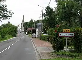 The road into Bourdon | |
Location of Bourdon | |
 Bourdon  Bourdon | |
| Coordinates: 49°59′17″N 2°04′35″E / 49.9881°N 2.0764°E | |
| Country | France |
| Region | Hauts-de-France |
| Department | Somme |
| Arrondissement | Amiens |
| Canton | Ailly-sur-Somme |
| Intercommunality | CC Nièvre et Somme |
| Government | |
| • Mayor (2020–2026) | Anthony Delassus[1] |
| Area 1 | 6.97 km2 (2.69 sq mi) |
| Population | 371 |
| • Density | 53/km2 (140/sq mi) |
| Time zone | UTC+01:00 (CET) |
| • Summer (DST) | UTC+02:00 (CEST) |
| INSEE/Postal code | 80123 /80310 |
| Elevation | 8–78 m (26–256 ft) (avg. 24 m or 79 ft) |
| 1 French Land Register data, which excludes lakes, ponds, glaciers > 1 km2 (0.386 sq mi or 247 acres) and river estuaries. | |
Bourdon (French pronunciation: [buʁdɔ̃]; Picard: Bordon) is a commune in the Somme department in Hauts-de-France in northern France.
Geography
Bourdon is situated on the D81 and D57 road junction, some 10 miles (16 km) northwest of Amiens.
Population
| Year | Pop. | ±% p.a. |
|---|---|---|
| 1968 | 259 | — |
| 1975 | 274 | +0.81% |
| 1982 | 294 | +1.01% |
| 1990 | 337 | +1.72% |
| 1999 | 373 | +1.13% |
| 2007 | 381 | +0.27% |
| 2012 | 388 | +0.36% |
| 2017 | 385 | −0.16% |
| Source: INSEE[3] | ||
See also
References
- ↑ "Répertoire national des élus: les maires". data.gouv.fr, Plateforme ouverte des données publiques françaises (in French). 2 December 2020.
- ↑ "Populations légales 2021". The National Institute of Statistics and Economic Studies. 28 December 2023.
- ↑ Population en historique depuis 1968, INSEE
External links
Wikimedia Commons has media related to Bourdon (Somme).
- Bourdon on the Quid website (in French)
This article is issued from Wikipedia. The text is licensed under Creative Commons - Attribution - Sharealike. Additional terms may apply for the media files.