| Bradlaugh Fields | |
|---|---|
 Hills and Holes Local Nature Reserve | |
| Type | Nature reserve |
| Location | Northampton |
| OS grid | SP 765 639 |
| Area | 17.5 hectares |
| Managed by | Wildlife Trust for Bedfordshire, Cambridgeshire and Northamptonshire |
Bradlaugh Fields is a 60-hectare (150-acre) open space in Northampton.[1] The site is a former golf course. In 1987 it was proposed to build housing on the site, but after a campaign by local residents it was acquired by Northampton Borough Council and opened as a wildlife park in 1998. It was named after Charles Bradlaugh, a leading nineteenth century radical and atheist who was MP for Northampton.[2] Three fields with a total area of 17.5 hectares are managed by the Wildlife Trust for Bedfordshire, Cambridgeshire and Northamptonshire as a nature reserve also called Bradlaugh Fields.[3] Hills and Holes is at the southern end and two adjoining meadows, Scrub Field and Quarry Field, are at the northern end.[4] Hills and Holes is an 8.3 hectare Local Nature Reserve (LNR)[5][6] and Scrub Field is a 5.1-hectare (13-acre) LNR.[7][8]
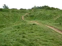
Bradlaugh Fields nature reserve has ancient hedgerows and unimproved grassland. Birds include blue tits, chiffchaffs, great spotted woodpeckers, sparrowhawks, redwings and fieldfares.[3] Hill and Holes is an ancient disused quarry which has grassed ridges and hollows, some of them steeply sloping. There are a variety of habitats including limestone grassland.[5] Scrub Field has a diverse selection of wild flowers, including Knautia arvensis and knapweed in higher areas, and bird's-foot trefoil and yellow rattle lower down.[7]

There is access to Hills and Holes from Kettering Road, and other access points include a footpath from Aintree Road which passes between Scrub Field and Quarry Field.
References
- ↑ "Bradlaugh Fields". Northampton Borough Council. Retrieved 1 May 2017.
- ↑ "History of your local wildlife park". Bradlaugh Fields and Barn, Northampton. Retrieved 1 May 2017.
- 1 2 "Bradlaugh Fields". Wildlife Trust for Bedfordshire, Cambridgeshire and Northamptonshire. Archived from the original on 23 December 2016. Retrieved 1 May 2017.
- ↑ Notice on the site
- 1 2 "Hills and Holes (also known as Hills & Hollows)". Local Nature Reserves. Natural England. Archived from the original on 21 December 2016. Retrieved 1 May 2017.
- ↑ "Map of Hills and Holes". Local Nature Reserves. Natural England. Retrieved 1 May 2017.
- 1 2 "Scrub Field". Local Nature Reserves. Natural England. 25 March 2013. Archived from the original on 22 December 2016. Retrieved 1 May 2017.
- ↑ "Map of Scrub Field". Local Nature Reserves. Natural England. Retrieved 1 May 2017.