Brownsburg | |
|---|---|
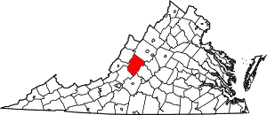
 Brownsburg Location within the Commonwealth of Virginia  Brownsburg Brownsburg (the United States) | |
| Coordinates: 37°55′42″N 79°19′9″W / 37.92833°N 79.31917°W | |
| Country | United States |
| State | Virginia |
| County | Rockbridge |
| Time zone | UTC−5 (Eastern (EST)) |
| • Summer (DST) | UTC−4 (EDT) |
| ZIP code | 24415[1] |
Brownsburg is an unincorporated community in Rockbridge County, Virginia, United States.[2]
The Brownsburg Historic District, Hays Creek Mill, Kennedy-Wade Mill, Level Loop, Mulberry Grove, and New Providence Presbyterian Church are listed on the National Register of Historic Places.[3]
References
- ↑ "Brownsburg ZIP Code". zipdatamaps.com. 2022. Retrieved November 30, 2022.
- ↑ "Brownsburg, Virginia". Geographic Names Information System. United States Geological Survey, United States Department of the Interior.
- ↑ "National Register Information System". National Register of Historic Places. National Park Service. July 9, 2010.
Wikimedia Commons has media related to Brownsburg, Virginia.
This article is issued from Wikipedia. The text is licensed under Creative Commons - Attribution - Sharealike. Additional terms may apply for the media files.
