Bula | |
|---|---|
Sector | |
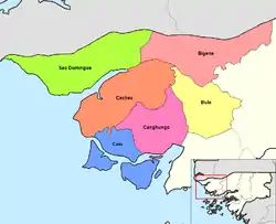 A map showing the sectors of Guinea-Bissau; Bula is on the far right in yellow. | |
| Coordinates: 12°006′014″N 15°042′029″W / 12.10389°N 15.70806°W | |
| Country | Guinea-Bissau |
| Region | Cacheu |
Bula is a Sector in the Cacheu Region of Guinea-Bissau.
References
This article is issued from Wikipedia. The text is licensed under Creative Commons - Attribution - Sharealike. Additional terms may apply for the media files.