| Burches Run Wildlife Management Area | |
|---|---|
IUCN category V (protected landscape/seascape)[1] | |
 Sign for the WMA, still not updated (as of June 2009) to reflect its name change. | |
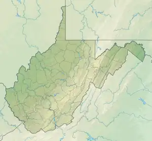
 Location of Burches Run Wildlife Management Area in West Virginia | |
| Location | Marshall, West Virginia, United States |
| Coordinates | 39°58′25″N 80°37′38″W / 39.97361°N 80.62722°W |
| Area | 55 acres (22 ha) |
| Elevation | 798 ft (243 m)[2] |
| Operator | Wildlife Resources Section, WVDNR |
Burches Run Wildlife Management Area, formerly Burches Run Lake WMA, is located on 55 acres (22 ha) near Wheeling in Marshall County, West Virginia. Until 2005 the wildlife management area contained a lake[3] impounded by a dam at risk of failure.[4] The name change occurred after the dam was removed. The terrain climbs gently above Burches Run and is covered by a mature oak-hickory second-growth forest.[3]
Directions
Burches Run WMA is located at the intersection of Pine Hill Road and Big Wheeling Creek Road about 8 miles (13 km) south of Wheeling, Pine Hill Road, also designated as County Route 14 is accessed off of WV State Route 88. Big Wheeling Creek Road is accessed near the intersection of US Route 40 and I-70 at Elm Grove.[3][5]
This map shows the WMA and where the lake that was removed used to be.
Hunting
Hunting opportunities, limited by the small size of the area, include deer, squirrel, and water fowl. Camping is prohibited at this WMA.[6]
See also
References
- ↑ "Burches Run Wildlife Management Area". Protected Planet. IUCN. Retrieved 30 April 2018.
- ↑ "Burches Run Wildlife Management Area". Elevation Query. U.S. Geological Survey. Archived from the original on 2011-07-21. Retrieved 2009-01-25.
- 1 2 3 Burches Run web page, West Virginia Department of Natural Resources
- ↑ West Virginia Department of Environmental Protection (2000). "West Virginia Statewide Flood Protection Plan, Appendix M - List of Deficient Dams" (PDF). West Virginia Conservation Agency. Retrieved 2008-07-12.
- ↑ Google Maps at Elm Grove, West Virginia
- ↑ Wildlife Management Areas West Virginia Division of Natural Resources