Caddo Mills, Texas | |
|---|---|
.jpg.webp) Main Street in Caddo Mills | |
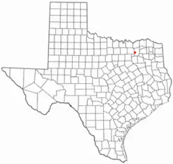
 Location of Caddo Mills, Texas | |
 | |
| Coordinates: 33°3′53″N 96°13′45″W / 33.06472°N 96.22917°W | |
| Country | United States |
| State | Texas |
| County | Hunt |
| Area | |
| • Total | 4.22 sq mi (10.94 km2) |
| • Land | 4.21 sq mi (10.92 km2) |
| • Water | 0.01 sq mi (0.02 km2) |
| Elevation | 531 ft (162 m) |
| Population (2010) | |
| • Total | 1,338 |
| • Estimate (2019)[2] | 1,698 |
| • Density | 402.94/sq mi (155.56/km2) |
| Time zone | UTC-6 (Central (CST)) |
| • Summer (DST) | UTC-5 (CDT) |
| ZIP code | 75135 |
| Area code | 903 |
| FIPS code | 48-11716[3] |
| GNIS feature ID | 1331827[4] |
| Website | www |
Caddo Mills (/ˈkædoʊ/ KA-doh) is a city in Hunt County, Texas, United States. The population was 1,338 at the 2010 census,[5] up from 1,149 at the 2000 census.
Geography
Caddo Mills is located in Northeast Texas at the western edge of Hunt County at 33°03′53″N 96°13′45″W / 33.064748°N 96.229040°W (33.064748, –96.229040).[6] Texas State Highway 66 passes through the center of the city, leading northeast 9 miles (14 km) to Greenville, the county seat, and southwest the same distance to Royse City. Downtown Dallas is 41 miles (66 km) southwest of Caddo Mills.
According to the United States Census Bureau, the city has a total area of 3.8 square miles (9.8 km2), of which 0.01 square miles (0.02 km2), or 0.25%, is covered by water.[5] West Caddo Creek, part of the Sabine River watershed, flows through the southwestern corner of the city.
Demographics
| Census | Pop. | Note | %± |
|---|---|---|---|
| 1940 | 390 | — | |
| 1950 | 509 | 30.5% | |
| 1960 | 732 | 43.8% | |
| 1970 | 935 | 27.7% | |
| 1980 | 1,060 | 13.4% | |
| 1990 | 1,068 | 0.8% | |
| 2000 | 1,149 | 7.6% | |
| 2010 | 1,338 | 16.4% | |
| 2020 | 1,495 | 11.7% | |
| 2019 (est.) | 2,321 | [2] | 73.5% |
| U.S. Decennial Census[7] | |||
| Race | Number | Percentage |
|---|---|---|
| White (NH) | 1,197 | 80.07% |
| Black or African American (NH) | 47 | 3.14% |
| Native American or Alaska Native (NH) | 7 | 0.47% |
| Asian (NH) | 2 | 0.13% |
| Some Other Race (NH) | 4 | 0.27% |
| Mixed/Multi-Racial (NH) | 50 | 3.34% |
| Hispanic or Latino | 188 | 12.58% |
| Total | 1,495 |
As of the 2020 United States census, there were 1,495 people, 583 households, and 435 families residing in the city.
Education
The city is served by the Caddo Mills Independent School District.
Transportation
Major highways
 Interstate 30
 U.S. Highway 67 (runs concurrently with Interstate 30)
 State Highway 66
Air
The city of Caddo Mills owns the Caddo Mills Municipal Airport, which provides general-aviation services to the area.[10]
Notable person
- Guy Benton Johnson, sociologist
Notes
References
- ↑ "2019 U.S. Gazetteer Files". United States Census Bureau. Retrieved August 7, 2020.
- 1 2 "Population and Housing Unit Estimates". United States Census Bureau. May 24, 2020. Retrieved May 27, 2020.
- ↑ "U.S. Census website". United States Census Bureau. Retrieved January 31, 2008.
- ↑ "US Board on Geographic Names". United States Geological Survey. October 25, 2007. Retrieved January 31, 2008.
- 1 2 "Geographic Identifiers: 2010 Census Summary File 1 (G001): Caddo Mills city, Texas". American Factfinder. U.S. Census Bureau. Archived from the original on February 13, 2020. Retrieved March 19, 2018.
- ↑ "US Gazetteer files: 2010, 2000, and 1990". United States Census Bureau. February 12, 2011. Retrieved April 23, 2011.
- ↑ "Census of Population and Housing". Census.gov. Retrieved June 4, 2015.
- ↑ "Explore Census Data". data.census.gov. Retrieved May 22, 2022.
- ↑ "About the Hispanic Population and its Origin". www.census.gov. Retrieved May 18, 2022.
- ↑ FAA Airport Form 5010 for 7F3 PDF. Federal Aviation Administration, Effective 26 April 2018.
