Caguana Ceremonial Ball Courts Site | |
 Taíno ball courts at Caguana Site | |
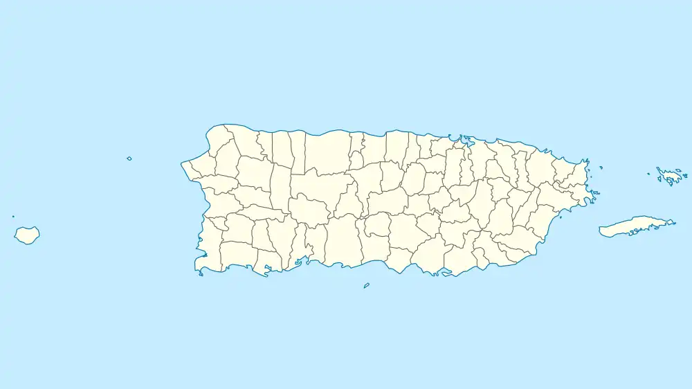 Caguana Ceremonial Ball Courts Site Location of the Caguana Site in Puerto Rico | |
| Location | Highway 111, Km 12.3 Utuado, Puerto Rico |
|---|---|
| Coordinates | 18°17′42″N 66°46′52″W / 18.294870°N 66.780974°W |
| Area | 7 acres (2.8 ha)[1] |
| Built | Around 1270 AD |
| MPS | Ball Court/Plaza Sites of Puerto Rico and the U.S. Virgin Islands |
| NRHP reference No. | 92001671[2] |
| Significant dates | |
| Added to NRHP | December 17, 1992 |
| Designated NHL | November 4, 1993[3] |
The Caguana Ceremonial Ball Courts Site (often referred to as Caguana Site) is an archaeological site located in Caguana, Utuado in Puerto Rico, considered to be one of the most important Pre-Columbian sites in the West Indies. The site is known for its well-preserved ceremonial ball courts and petroglyph-carved monoliths. Studies estimate the in-situ courts to be over 700 years old, built by the Taíno around 1270 AD.[4]
Overview
Approximately 13 ball courts and plazas (bateyes) have been identified and many have been restored to their original state. Monoliths and petroglyphs carved by the Taínos can be seen among the rocks and stones, some weighing over a ton, that were most likely brought from the Tanama River located adjacent to the site.[5]
The plan of the site and the positions of the ball courts indicate an alignment with specific astronomical events, and the site might have functioned as a place to observe and possibly predict astronomical events such as planetary and stellar transits, conjunctions and alignments. Numerous of the petroglyphs depict astronomical objects such as the moon, stars and planets. Although the site is not listed as a world heritage site, its archaeoastronomical features are well-documented and recognized by the UNESCO Astronomy and World Heritage Initiative.[5][6]
History
The site of the modern archaeological site was originally known as Corrales de los Indios (Spanish for "Indian corrals") by locals after the corral-like outlines of some of the ball courts. The first exploration and survey works in the site were led by American anthropologist John Alden Mason in 1914. The site has been under continuous study since the 1930s, at first by archaeologists from Yale University such as Irvin Rouse, and later by the Institute of Puerto Rican Culture and Dr. Ricardo Alegría. The interpretative park and a small museum were first opened to visitors in 1965.[7]
Designations
The Institute of Puerto Rican Culture manages the site as a park under the name Caguana Indigenous Ceremonial Center (Parque Ceremonial Indígena de Caguana). The National Park Service has placed it on the National Register of Historic Places, and designated it as a National Historic Landmark (under the name Caguana Site). It was listed on the National Register in 1992 and designated a U.S. National Historic Landmark in 1993.[3][2][1]
The park also includes a small museum containing Taíno artifacts, archaeological exhibits and a small botanical garden featuring some of the plants the Taínos harvested for food such as sweet potatoes, cassava, corn, and yautía. Many of the trees used by the Taínos to construct their homes (bohíos), such as mahogany and ceiba can also be seen throughout the park.[5]
Also the site has been included in the UNESCO Astronomy World Heritage List.
Gallery
Scenes at Caguana Ceremonial Ball Courts Site:
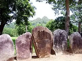 Stones and mountain behind
 Caguana Ceremonial Ball Courts Site
 Ball Court
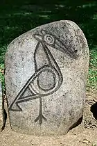 Bird drawn on stone
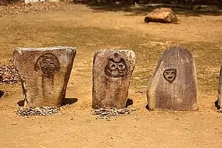 Faces drawn on stones
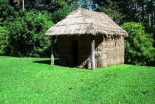 Traditional Bohio like the ones built by the Taino
See also
References
- 1 2 Mark R. Barnes (January 25, 1993). "National Historic Landmark Nomination: Caguana Ceremonial Ball Courts Site". National Park Service. and Accompanying four photos, from 1991
- 1 2 "National Register Information System". National Register of Historic Places. National Park Service. April 15, 2008.
- 1 2 "Caguana Site". National Historic Landmark summary listing. National Park Service. Archived from the original on 2007-12-06. Retrieved 2007-06-28.
- ↑ "Caguana Ceremonial Ball Courts Site--Historic Places in Puerto Rico and the Virgin Islands; A National Register of Historic Places Travel Itinerary". www.nps.gov.
- 1 2 3 "UNESCO Astronomy and World Heritage Webportal - Show entity". www3.astronomicalheritage.net. Retrieved 2021-11-29.
- ↑ Oliver, José R. (1998). El centro ceremonial de Caguana, Puerto Rico: Simbolismo iconográfico, cosmovisión y el poderío caciquil Taíno de Boriquén. ISBN 9780860549154.
- ↑ "Parque Ceremonial Indígena de Caguana. Puerto Rico". pueblosoriginarios.com. Retrieved 2021-11-29.
External links
- National Park Service Images
- Additional National Park Service Images
- Centro Ceremonial Indígena de Caguana, Utuado - Puerto Rican Cultural Institute
- National Park Service site description for visitors Archived 2013-06-19 at the Wayback Machine
- National Historic Landmark description by the National Park Service
- Parque Ceremonial Indigena de Caguana Official Page
- Summary sheet from the Puerto Rico State Historic Preservation Office (in Spanish)

