Cam Phước Tây | |
|---|---|
 Cam Phước Tây Location in Vietnam | |
| Coordinates: 11°59′26″N 109°02′30″E / 11.9905°N 109.0416°E | |
| Country | |
| Province | Khánh Hòa |
| District | Cam Lâm District |
| Founded | 1985[1] |
| Area | |
| • Total | 3,354 sq mi (8,686 km2) |
| Population (1999) | |
| • Total | 6,222 |
| • Density | 190/sq mi (72/km2) |
| Time zone | UTC+07:00 (Indochina Time) |
Cam Phước Tây is a rural commune (xã) of Cam Lâm District in Khánh Hòa Province, Vietnam.[2]
Geography
Cam Phước Tây has a metropolitan area of 8,686 km2 (3,354 sq mi) and a population of about 6,222.[3]
References
- ↑ 230/1985/QĐ-HĐBT
- ↑ "Administrative subdivisions". General Statistics Office of Vietnam. Archived from the original on 2015-11-13. To find information at reference, go to row 56, then row 570, and it is listed on row 22459.
- ↑ "Mã số đơn vị hành chính Việt Nam". Bộ Thông tin & Truyền thông. Archived from the original on March 24, 2013. Retrieved April 10, 2012.
Capital: Nha Trang | ||
| Nha Trang | Ward (19): Lộc Thọ · Ngọc Hiệp · Phước Hải · Phước Hòa · Phước Long · Phước Tân · Phước Tiến · Phương Sài · Phương Sơn · Tân Lập · Vạn Thắng · Vạn Thạnh · Vĩnh Hải · Vĩnh Hòa · Vĩnh Phước · Vĩnh Trường · Vĩnh Nguyên · Vĩnh Thọ · Xương Huân commune (8): Phước Đồng · Vĩnh Phương · Vĩnh Thạnh · Vĩnh Trung · Vĩnh Thái · Vĩnh Hiệp · Vĩnh Ngọc · Vĩnh Lương | 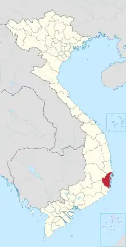 |
| Cam Ranh |
| |
| Ninh Hòa |
| |
| Cam Lâm District | Cam An Bắc · Cam An Nam · Cam Hải Đông · Cam Hải Tây · Cam Hiệp Bắc · Cam Hiệp Nam · Cam Hòa · Cam Phước Tây · Cam Tân · Cam Thành Bắc · Suối Tân · Sơn Tân · Suối Cát | |
| Diên Khánh District |
| |
| Khánh Sơn District |
| |
| Khánh Vĩnh District |
| |
| Trường Sa District |
| |
| Vạn Ninh District |
| |