| Cap-Vert | |
|---|---|
 Cap-Vert | |
| Highest point | |
| Coordinates | 14°46′N 17°24′W / 14.77°N 17.4°W[1] |
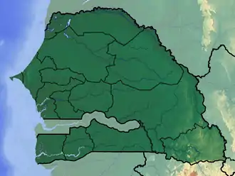
Cap-Vert is a volcanic field in Senegal with a surface of 100 square kilometres (39 sq mi). The field covers the Cape Verde peninsula close to Dakar and was active until 600,000 years ago.[1] It consists of a number of outcrops and two 100 metres (330 ft) high hills.[2] The position of the dykes and lava flows has been influenced by local fault systems.[3]
References
- 1 2 "Cap-Vert". Global Volcanism Program. Smithsonian Institution.
- ↑ Lo, Dia & Kampunzu 1992, p. 281.
- ↑ Lo, Dia & Kampunzu 1992, p. 283.
Sources
- Lo, Papa Goumbo; Dia, Abdoulaye; Kampunzu, Ali Basira (August 1992). "Cenozoic volcanism in Western Senegal and its relationship to the opening of the Central Atlantic Ocean". Tectonophysics. 209 (1–4): 281–291. doi:10.1016/0040-1951(92)90035-5. ISSN 0040-1951.
This article is issued from Wikipedia. The text is licensed under Creative Commons - Attribution - Sharealike. Additional terms may apply for the media files.