Cape Foulwind | |
|---|---|
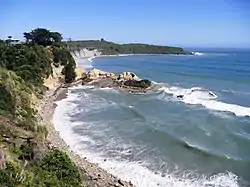
 Looking west across Gibsons Beach to Cape Foulwind | |
 Cape Foulwind Location of Cape Foulwind | |
| Coordinates: 41°44′57″S 171°27′51″E / 41.74917°S 171.46417°E | |
| Offshore water bodies | Tasman Sea |
| Formed by | Erosion |
| Geology | Gneiss |
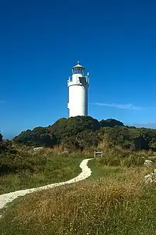
Cape Foulwind is a headland on the West Coast of the South Island of New Zealand, overlooking the Tasman Sea. It is located 11 kilometres (6.8 mi) west of the town of Westport. There is a lighthouse located on a prominent site on the headland. A walkway beginning at the lighthouse carpark traverses the rocky headland to Tauranga Bay and passes close by a colony of New Zealand fur seals. There is limestone quarry in the area, and a cement works operated nearby from 1958 to 2016.
In the lee of the cape, eastwards toward the Buller River mouth, lies Carters Beach, which is claimed to be the only safe swimming beach on the West Coast of the South Island.[1]
Toponymy
The headland was initially named Rocky Cape by Abel Tasman, the first European to sight it, in 1642.[2] However, the current name, Cape Foulwind, was given by English explorer James Cook in 1770[3] after his ship Endeavour, was blown quite a distance offshore from this point.[2]
Lighthouse
The first lighthouse at Cape Foulwind was illuminated on 1 September 1876. However, the timber support structure of this initial lighthouse did not survive the environmental conditions. Consequently, a replacement lighthouse was erected on a concrete tower in 1926. Operated by Maritime New Zealand,[4] the lighthouse is registered as a Category 2 Historic Place.[5]
Walkway

The Cape Foulwind Walkway is a 3.4 kilometres (2.1 mi) (one-way) path situated above rocky headlands, extending from Tauranga Bay to the carpark at the Cape Foulwind Lighthouse. Notable features of the walkway encompass views of mountains and coastline, a thriving colony of New Zealand fur seals (kekeno), and the lighthouse.[6] The cliffs of Cape Foulwind, along with the adjacent small offshore islands, serve as roosting and breeding grounds for various seabird species, such as Australasian gannets. sooty shearwaters, fluttering shearwaters and fairy prions. Wall island, a small rocky islet, offshore from the seal colony at Tauranga Bay, plays a vital role as habitat for seabird colonies and Little penguins (kororā). Additionally, there is a chance to occasionally spot Hector's dolphin and orcas from the walkway.[7]
Cement works

In 1924, the Grey River Argus reported that the National Portland Cement Company was to be floated, to mine and process deposits of limestone and marl at Cape Foulwind.[8] A proposal to establish a cement works at Cape Foulwind was announced in 1946.[9] In 1953, it was reported that British interests had purchased a large area of land at Cape Foulwind.[10] However, it was not until 1955 that the British company Tunnel Portland Cement (subsequently Hanson Cement) made a firm commitment to construct a plant.[11] The plant, with an expected production capability of 120,000 tons per annum, was set to employ 200 workers and utilize 40,000 tonnes of Buller coal annually. The capital required for the plant would be £2,500,000, with only £100,000 to be raised in New Zealand.[12]
The new plant at Cape Foulwind commenced production in November 1958,[13] and its official opening took place on 15 February 1959.[14]
In 2013, Holcim, the owner, announced plans to close the factory and cease cement production in New Zealand. The Cape Foulwind cement works ceased operations in June 2016 after 58 years, resulting in the loss of 105 jobs.[15][16]
Mineral sands mining
In May 2022, Westland Mineral Sands, a mining company, was granted resource consent by a joint hearings panel of the West Coast Regional Council and Buller District Council for a proposal to mine 500,000 tonnes of mineral sands over seven years, at its property at Okari, south of Cape Foulwind.[17] A group of local residents appealed the decision of the hearings panel in the Environment Court, seeking lower noise level limits and more restrictions on operating hours.[18][19]
The mining of mineral sands was projected to begin in October 2022, with 2 hectares (4.9 acres) to be strip-mined at a time.[20][19]
Railway line
The Cape Foulwind Railway was a branch railway line built in 1886 by the Westport Harbour Board, to transport rocks from their quarry to the breakwaters in the Buller River.[21]
Three Steeples Rocks and Black Reef

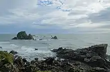
The Three Steeples and Black Reef are 28 rocky islets, rising to a bit over 20 m (66 ft) high, approximately 2 km (1.2 mi) north of Cape Foulwind.[22] They are granite rocks,[23] named by Jules Dumont d'Urville as Les Trois Cloches on 12 January 1827[24] and depicted as Three Steeples on James Wyld's 1839 map.[25] They had been known to sealers as Black Rocks since at least 1826.[26] Patrick O'Regan thought these were the rocks illustrated by Isaack Gilsemans, when Tasman first anchored in New Zealand waters on 14 December 1642.[27] The Dutch inscription beneath the drawings has been translated as the Rocky Point.[28]
The lighthouse has proven effective, with no recorded wrecks on the rocks.[29] However, in 1881, the Anchor Shipping and Foundry Company's paddle steamer Charles Edward (1864-1908)[30] was holed and then towed to Westport.[31] Similarly, in 1946, the Union Steamship's collier, Karepo, stranded on the rocks in a thick fog, but was later floated off.[32] A navigable channel, about 1⁄4 mi (0.40 km) wide, runs between the Cape and Black Reef.[33][34]
Spotted shags roost on the Steeples, where salt-resistant taupata grows on the rock tops.[35]
Rock lobster (kōura), blue cod (rāwaru), gurnard (kumukumu), sharks and snapper (tāmure) are fished around the rocks and orca probably feed off the fur seal colonies.[35] The shellfish Cantharidus puysegurensis[36] and Leptomya retiaria have been found on the rocks.[37]
Gallery
 Cape Foulwind living up to its name, with the cement works centre foreground. |
 Cape Foulwind: Looking out on the Tasman Sea |
References
- ↑ Simon Nathan (12 June 2015). "'West Coast places - Westport'". Te Ara - the Encyclopedia of New Zealand. Archived from the original on 2 July 2016. Retrieved 15 June 2016.
- 1 2 "West Coast History". Archived from the original on 25 April 2016. Retrieved 15 June 2016.
- ↑ "Cape Foulwind and Tauranga Bay". Archived from the original on 13 May 2016. Retrieved 15 June 2016.
- ↑ "Cape Foulwind". Maritime New Zealand. Archived from the original on 28 September 2022. Retrieved 28 September 2022.
- ↑ "Cape Foulwind Lighthouse". Heritage New Zealand. Archived from the original on 28 March 2023. Retrieved 29 March 2023.
- ↑ "Cape Foulwind Walkway". www.doc.govt.nz. Archived from the original on 27 September 2022. Retrieved 27 September 2022.
- ↑ Turner, Elen (7 November 2021). "Enjoy a walk on the wild side at Cape Foulwind in Westport". NZ Herald. Archived from the original on 17 December 2021. Retrieved 27 September 2022.
- ↑ "Cement company to work Cape Foulwind lime deposits". Grey River Argus. 24 November 1924 – via Papers Past.
- ↑ "Cement manufacture - New project to exploit Cape Foulwind clay". Wanganui Chronicle. 31 January 1946. Archived from the original on 28 September 2022. Retrieved 28 September 2022 – via Papers Past.
- ↑ "Colombo Plan assistance - £250,000 Grant for cement works protest by Westport Borough Council". The Press. 10 April 1953. Archived from the original on 28 September 2022. Retrieved 28 September 2022 – via Papers Past.
- ↑ "New cement works - Cape Foulwind scheme - Sponsorship by British firm". The Press. 11 November 1955. Archived from the original on 28 September 2022. Retrieved 28 September 2022 – via Papers Past.
- ↑ "Cement works at Westport - Plant Expected In August -Production a year later". The Press. 28 December 1955. Archived from the original on 28 September 2022. Retrieved 28 September 2022 – via Papers Past.
- ↑ "Cape Foulwind Cement - Production started at works". The Press. 22 November 1958. Archived from the original on 27 September 2022. Retrieved 28 September 2022 – via Papers Past.
- ↑ "New cement works opened - Ceremony at Cape Foulwind". The Press. 16 February 1959 – via Papers Past.
- ↑ Scanlon, Lee (29 June 2016). "'It will be a tough old day tomorrow'". NZ Herald. Archived from the original on 19 May 2022. Retrieved 23 June 2022.
- ↑ Naish, Joanne (28 December 2020). "Plan to decide future of cement plant land with spectacular West Coast views". Stuff. Archived from the original on 7 July 2021. Retrieved 27 September 2022.
- ↑ McMahon, Brendon (11 May 2022). "Controversial mine proposal gets green light". Stuff. Archived from the original on 15 July 2022. Retrieved 27 September 2022.
- ↑ McMahon, Brendon (2 June 2022). "Cape Foulwind residents lodge appeal against controversial sand mine". Stuff. Archived from the original on 27 September 2022. Retrieved 27 September 2022.
- 1 2 Naish, Joanne (15 July 2022). "'Not just dirty miners': 100-year plan to mine sand for minerals on the West Coast". Stuff. Retrieved 28 September 2022.
- ↑ Mills, Laura (16 September 2022). "'Rare earth' mine opening". Otago Daily Times Online News. Retrieved 28 September 2022.
- ↑ Churchman, Geoffrey B; Hurst, Tony (2001). The Railways of New Zealand: A Journey through History (2 ed.). Transpress New Zealand. p. 192. ISBN 0-908876-20-3.
- ↑ "Three Steeples, West Coast". NZ Topo Map. Retrieved 31 December 2022.
- ↑ Robert M Orris (September 1976). "Late Cenozoic Geology of the West Coast Shelf" (PDF). NIWA.
- ↑ "Maori Nomenclature". Otago Witness. 1 February 1911. Retrieved 31 December 2022.
- ↑ "Chart of New Zealand". teara.govt.nz. 1839. Retrieved 31 December 2022.
- ↑ Ian Smith (June 2002). "The New Zealand Sealing Industry" (PDF). DoC.
- ↑ "Pioneers Of The Past". Otago Witness. 15 November 1911. Retrieved 16 December 2022.
- ↑ Gilsemans, Isaac (December 1642). "Thus appears the main land to south of the Rocky Point [Cape Foulwind] when you sail along the coast and views of the Rocky Point which appear thus as you can see below". natlib.govt.nz. Retrieved 6 January 2023.
- ↑ Halse, Frederick James. "1863-1936: Index wreck chart". natlib.govt.nz. Retrieved 31 December 2022.
- ↑ "Paddle Steamer CHARLES EDWARD built by Archibald Denny in 1864 for J Galbraith, Glasgow. Passenger / Cargo". www.clydeships.co.uk. Retrieved 31 December 2022.
- ↑ "Shipping". New Zealand Times. 25 February 1881. Retrieved 31 December 2022.
- ↑ "Collier On Reef". Ashburton Guardian. 23 January 1946. Retrieved 31 December 2022.
- ↑ "United States Defense Mapping Agency - Sailing Directions for New Zealand". 1976.
- ↑ Heaphy, Charles. "The Black Reef & 3 Steeples". natlib.govt.nz. Retrieved 1 January 2023.
- 1 2 D.M. Neale (April 2007). "West Coast Marine and Coastal Environment" (PDF). West Coast Marine Protection Forum.
- ↑ "NZ Mollusca - Cantharidus puysegurensis". www.mollusca.co.nz. Retrieved 1 January 2023.
- ↑ "NZ Mollusca - Leptomya retiaria". www.mollusca.co.nz. Retrieved 1 January 2023.
