| Carrigvore | |
|---|---|
| Carraig Mhór | |
 Gravale (highest) with Carrigvore (right) from SE | |
| Highest point | |
| Elevation | 682 m (2,238 ft)[1] |
| Prominence | 67 m (220 ft)[1] |
| Listing | Hewitt, Arderin, Simm, Vandeleur-Lynam |
| Coordinates | 53°07′49″N 6°19′24″W / 53.130277°N 6.323459°W |
| Naming | |
| English translation | big rock |
| Language of name | Irish |
| Geography | |
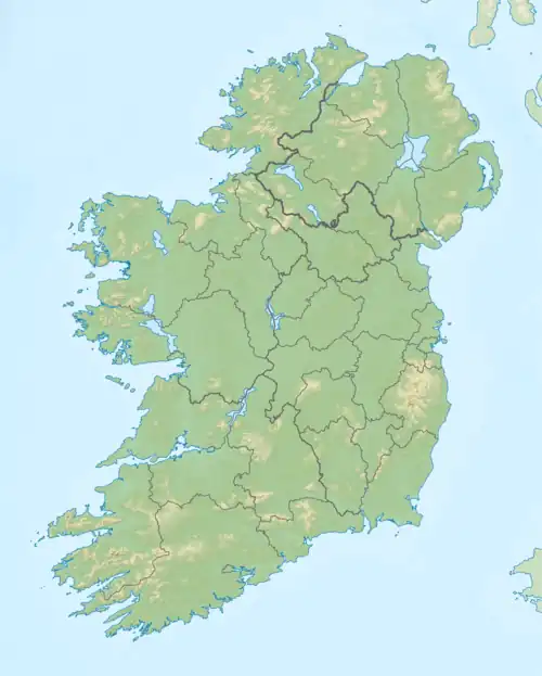
 Carrigvore Location in Ireland | |
| Location | Wicklow, Republic of Ireland |
| Parent range | Wicklow Mountains |
| OSI/OSNI grid | O122101[1] |
| Topo map | OSi Discovery 56 |
| Geology | |
| Mountain type | Granite with microcline phenocrysts[1] |
| Climbing | |
| Easiest route | from the Sally Gap, or along the R115 |
Carrigvore (Irish: Carraig Mhór, meaning 'big rock')[2] at 682 metres (2,238 ft), is the 111th–highest peak in Ireland on the Arderin scale,[3] and the 134th–highest peak on the Vandeleur-Lynam scale.[4][5] Carrigvore is in the middle section of the Wicklow Mountains, in Ireland, and is part of a large north-east to south-west "boggy ridge" that runs from the Sally Gap to Carrigvore, and then on to Gravale 718 metres (2,356 ft); after a col, the ridge continues south-westwards to meet Duff Hill 720 metres (2,360 ft), which is part of the larger massif of Mullaghcleevaun 849 metres (2,785 ft).[6][7]

View to summit from the Sally Gap
See also
References
Citations
- 1 2 3 4 "Carrigvore". MountainViews Online Database. Retrieved 15 July 2019.
- ↑ Paul Tempan (February 2012). "Irish Hill and Mountain Names" (PDF). MountainViews.ie.
- ↑ Simon Stewart (October 2018). "Arderins: Irish mountains of 500+m with a prominence of 30m". MountainViews Online Database.
- ↑ Simon Stewart (October 2018). "Vandeleur-Lynams: Irish mountains of 600+m with a prominence of 15m". MountainViews Online Database.
- ↑ Mountainviews, (September 2013), "A Guide to Ireland's Mountain Summits: The Vandeleur-Lynams & the Arderins", Collins Books, Cork, ISBN 978-1-84889-164-7
- ↑ Fairbairn, Helen (2014). Dublin & Wicklow: A Walking Guide. Collins Press. ISBN 978-1848892019.
- ↑ Dillion, Paddy (1993). The Mountains of Ireland: A Guide to Walking the Summits. Cicerone. ISBN 978-1852841102.
Walk 4: Carrigvore, Gravale, Duff Hill, Mullaghcleevaun East Top, Mullaghcleevaun
Bibliography
- Fairbairn, Helen (2014). Ireland's Best Walks: A Walking Guide. Collins Press. ISBN 978-1848892118.
- Fairbairn, Helen (2014). Dublin & Wicklow: A Walking Guide. Collins Press. ISBN 978-1848892019.
- MountainViews Online Database (Simon Stewart) (2013). A Guide to Ireland's Mountain Summits: The Vandeleur-Lynams & the Arderins. Collins Books. ISBN 978-1-84889-164-7.
- Dillion, Paddy (1993). The Mountains of Ireland: A Guide to Walking the Summits. Cicerone. ISBN 978-1852841102.
External links
- MountainViews: The Irish Mountain Website, Carrigvore
- MountainViews: Irish Online Mountain Database
- The Database of British and Irish Hills , the largest database of British Isles mountains ("DoBIH")
- Hill Bagging UK & Ireland, the searchable interface for the DoBIH
This article is issued from Wikipedia. The text is licensed under Creative Commons - Attribution - Sharealike. Additional terms may apply for the media files.


.jpg.webp)
