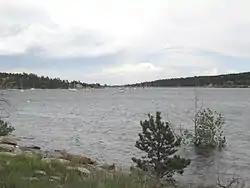
| Carter Lake Dam | |
|---|---|
 Carter Lake | |
 Location of Carter Lake Dam in Colorado  Carter Lake Dam (the United States) | |
| Location | Larimer County, Colorado, U.S. |
| Coordinates | 40°19′32″N 105°12′44″W / 40.32553°N 105.21218°W |
| Purpose | flood control, irrigation |
| Status | Operational |
| Opening date | 1950 |
| Owner(s) | U.S. Bureau of Reclamation |
| Operator(s) | Northern Colorado Water Conservancy District |
| Dam and spillways | |
| Type of dam | Earthen |
| Height | 214 ft (65 m) |
| Length | 1,235 ft (376 m) |
| Reservoir | |
| Creates | Carter Lake |
| Total capacity | 112,230 acre⋅ft (0.13843 km3) |
| Surface area | 900 acres (3.6 km2) |
| Normal elevation | 1,756 m (5,761 ft) |
Carter Lake Dam (National ID # CO01650) is a dam in Larimer County, Colorado.
The earthen dam was completed in 1950 by the United States Bureau of Reclamation, with a height of 214 feet (65 m), and a length of 1,235 feet (376 m) at its crest.[1] It contains offstream storage as part of the Bureau of Reclamation's Colorado-Big Thompson Project for flood control and irrigation. The dam is owned by the Bureau of Reclamation and operated by the Northern Colorado Water Conservancy District.
The reservoir it creates, Carter Lake Reservoir, has a water surface of 1,100 acres (450 ha), about eight miles of shoreline, more than 900 acres (360 ha) of surrounding public land, and a capacity of 112,230 acre-feet (138,430,000 m3).[2][3] Recreation includes fishing (for rainbow trout, kokanee, brown trout, splake, walleye, yellow perch, bluegill, salmon, largemouth bass, etc.), hunting, boating, camping and hiking.[4]
See also
References
- ↑ "Dam details - Carter Lake Dam - Bureau of Reclamation". Archived from the original on 2012-09-27. Retrieved 2012-08-11.
- ↑ "Project details - Colorado-Big Thompson Project - Bureau of Reclamation". Archived from the original on 2011-11-12. Retrieved 2011-08-25.
- ↑ "Parks and Open Lands - Carter Lake". Archived from the original on 2012-08-18. Retrieved 2012-08-11.
- ↑ "Carter Reservoir (Carter Lake), Colorado".