Chidrac | |
|---|---|
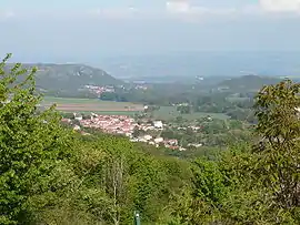 View of Chidrac from Lavelle | |
Location of Chidrac | |
 Chidrac 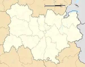 Chidrac | |
| Coordinates: 45°33′18″N 3°08′59″E / 45.555°N 3.1497°E | |
| Country | France |
| Region | Auvergne-Rhône-Alpes |
| Department | Puy-de-Dôme |
| Arrondissement | Issoire |
| Canton | Le Sancy[1] |
| Intercommunality | Agglo Pays d'Issoire |
| Government | |
| • Mayor (2020–2026) | Patrick Kindt[2] |
| Area 1 | 3.57 km2 (1.38 sq mi) |
| Population | 512 |
| • Density | 140/km2 (370/sq mi) |
| Time zone | UTC+01:00 (CET) |
| • Summer (DST) | UTC+02:00 (CEST) |
| INSEE/Postal code | 63109 /63320 |
| Elevation | 445–644 m (1,460–2,113 ft) (avg. 446 m or 1,463 ft) |
| 1 French Land Register data, which excludes lakes, ponds, glaciers > 1 km2 (0.386 sq mi or 247 acres) and river estuaries. | |
Chidrac (French pronunciation: [ʃidʁak]) is a commune in the Puy-de-Dôme department in Auvergne-Rhône-Alpes in central France.
Geography
The commune is located 8 kilometers west of Issoire. It is located on the Couze Pavin, a small waterway that flows into the Allier at Issoire.
Population
| Year | Pop. | ±% p.a. |
|---|---|---|
| 1968 | 387 | — |
| 1975 | 371 | −0.60% |
| 1982 | 379 | +0.31% |
| 1990 | 397 | +0.58% |
| 1999 | 377 | −0.57% |
| 2007 | 473 | +2.88% |
| 2012 | 468 | −0.21% |
| 2017 | 523 | +2.25% |
| Source: INSEE[4] | ||
See also
References
- ↑ "Décret 2014-210 du 21 février 2014 portant délimitation des cantons dans le département du Puy-de-Dôme" [2014-210 decree delimiting cantons of Puy-de-Dôme department]. Légifrance (in French). 21 February 2014.
- ↑ "Répertoire national des élus: les maires" (in French). data.gouv.fr, Plateforme ouverte des données publiques françaises. 13 September 2022.
- ↑ "Populations légales 2021". The National Institute of Statistics and Economic Studies. 28 December 2023.
- ↑ Population en historique depuis 1968, INSEE
Wikimedia Commons has media related to Chidrac.
This article is issued from Wikipedia. The text is licensed under Creative Commons - Attribution - Sharealike. Additional terms may apply for the media files.