| Site of Special Scientific Interest | |
 | |
| Location | Suffolk |
|---|---|
| Grid reference | TM 382 522[1] |
| Interest | Geological |
| Area | 1.1 hectares[1] |
| Notification | 1986[1] |
| Location map | Magic Map |
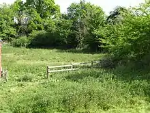
Chillesford Church Pit is a 1.1-hectare (2.7-acre) geological Site of Special Scientific Interest in Chillesford, south of Saxmundham in Suffolk.[1][2] It is a Geological Conservation Review site,[3] and it is in the Suffolk Coast and Heaths Area of Outstanding Natural Beauty.[4]
This site has deposits dating to the Early Pleistocene Bramertonian Stage, around 2.4 to 1.8 million years ago. Fossils of molluscs and pollen indicate a temperate climate dating to the Chillesford Crag formation. The Chillesford Clay and Chillesford Crag are parts for the Norwich Crag Formation.[5]
The site is private land with no public access.
References
- 1 2 3 4 "Designated Sites View: Chillesford Church Pit". Sites of Special Scientific Interest. Natural England. Retrieved 21 May 2017.
- ↑ "Map of Chillesford Church Pit". Sites of Special Scientific Interest. Natural England. Retrieved 21 May 2017.
- ↑ "Chillesford Church (Quaternary of East Anglia)". Geological Conservation Review. Joint Nature Conservation Committee. Retrieved 3 May 2017.
- ↑ "Suffolk Coast & Heaths Area of Outstanding Natural Beauty Management Plan 2013–2018" (PDF). Suffolk Coast & Heaths AONB. p. 76. Archived from the original (PDF) on 2016-08-15. Retrieved 6 August 2016.
- ↑ "Chillesford Church Pit citation" (PDF). Sites of Special Scientific Interest. Natural England. Archived from the original (PDF) on 4 May 2015. Retrieved 21 May 2017.
Wikimedia Commons has media related to Chillesford Church Pit.
52°07′01″N 1°28′41″E / 52.117°N 1.478°E
This article is issued from Wikipedia. The text is licensed under Creative Commons - Attribution - Sharealike. Additional terms may apply for the media files.