Cigeľ | |
|---|---|
Village | |
 | |
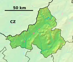 Cigeľ Location of Cigeľ in the Trenčín Region 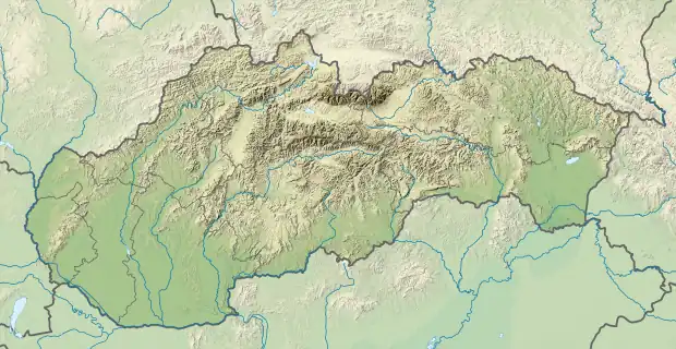 Cigeľ Location of Cigeľ in Slovakia | |
| Coordinates: 48°43′N 18°39′E / 48.717°N 18.650°E | |
| Country | |
| Region | Trenčín |
| District | Prievidza |
| First mentioned | 1362 |
| Area | |
| • Total | 17.34[1] km2 (6.70[1] sq mi) |
| Elevation | 450[2] m (1,480[2] ft) |
| Population (2021) | |
| • Total | 1,267[3] |
| Postal code | 971 01[2] |
| Area code | +421 46[2] |
| Car plate | PD |
| Website | www.cigel.sk |
Cigeľ (Hungarian: Cégely) is a village and municipality in Prievidza District in the Trenčín Region of western Slovakia.
History
In historical records the village was first mentioned in 1362.
Geography
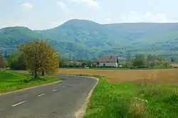
The municipality lies at an altitude of 460 metres and covers an area of 17.35 km². It has a population of about 1,036 people.
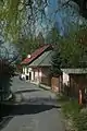
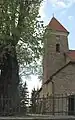
Gallery

Genealogical resources
The records for genealogical research are available at the state archive "Statny Archiv in Nitra, Slovakia"
- Roman Catholic church records (births/marriages/deaths): 1660-1895 (parish B)
See also
References
- 1 2 "Hustota obyvateľstva - obce [om7014rr_ukaz: Rozloha (Štvorcový meter)]". www.statistics.sk (in Slovak). Statistical Office of the Slovak Republic. 2022-03-31. Retrieved 2022-03-31.
- 1 2 3 4 "Základná charakteristika". www.statistics.sk (in Slovak). Statistical Office of the Slovak Republic. 2015-04-17. Retrieved 2022-03-31.
- ↑ "Počet obyvateľov podľa pohlavia - obce (ročne)". www.statistics.sk (in Slovak). Statistical Office of the Slovak Republic. 2022-03-31. Retrieved 2022-03-31.
External links
![]() Media related to Cigeľ at Wikimedia Commons
Media related to Cigeľ at Wikimedia Commons
This article is issued from Wikipedia. The text is licensed under Creative Commons - Attribution - Sharealike. Additional terms may apply for the media files.