Cleveland | |
|---|---|
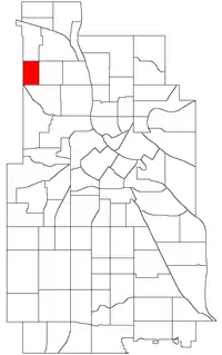
 Location of Cleveland within the U.S. city of Minneapolis | |
| Country | United States |
| State | Minnesota |
| County | Hennepin |
| City | Minneapolis |
| Community | Camden |
| Area | |
| • Total | 0.374 sq mi (0.97 km2) |
| Population (2020)[2] | |
| • Total | 3,139 |
| • Density | 8,400/sq mi (3,200/km2) |
| Time zone | UTC-6 (CST) |
| • Summer (DST) | UTC-5 (CDT) |
| ZIP code | 55411, 55412 |
| Area code | 612 |
| Website | www |
| Census | Pop. | Note | %± |
|---|---|---|---|
| 1980 | 3,220 | — | |
| 1990 | 3,216 | −0.1% | |
| 2000 | 3,440 | 7.0% | |
| 2010 | 3,025 | −12.1% | |
| 2020 | 3,139 | 3.8% |
Cleveland is a neighborhood in the Camden community in Minneapolis. Its boundaries are Dowling Avenue to the north, Penn Avenue North to the east, Lowry Avenue north to the south, and Xerxes Avenue North to the west. To the west of Xerxes Avenue is the suburb of Robbinsdale. Some people believe that the neighborhood is named after former United States President Grover Cleveland, while others maintain it is named after Horace Cleveland, a landscape architect who framed the development of the Minneapolis Park System in the 1880s. 45°01′11″N 93°18′50″W / 45.0196°N 93.3139°W[3]
It contains the Fournier House.[5]
References
- ↑ "Cleveland neighborhood in Minneapolis, Minnesota (MN), 55412 detailed profile". City-Data. 2011. Retrieved 2013-11-17.
- ↑ "Cleveland neighborhood data". Minnesota Compass. Retrieved 2023-02-19.
- ↑ Cleveland, Minneapolis, MN. Google Earth. Retrieved 2011-03-09.
- Cleveland, Minneapolis, MN. Google Earth. Retrieved 2011-03-09.
- ↑ DeCarlo, Peter J. (March 28, 2018) [2014]. "Fournier House". MNopedia. St. Paul: Minnesota Historical Society (published December 8, 2014). Retrieved December 15, 2018.
In 1908 Lawrence Fournier and his wife Mary purchased a lot in what is now the Cleveland neighborhood in North Minneapolis. The Fourniers' selection of a North Minneapolis lot reveals the increasing appeal of this area of the city to new residents. Minneapolis real estate developers had begun to promote the area's bucolic setting and its easy access to new street car lines.As the automobile became more popular and dependable after World War I, development increased at an even more rapid rate. The Cleveland neighborhood was unusually slow to develop, however, and the Fournier House was set in a rural atmosphere until a post-World War II building boom filled in many of the neighborhood's remaining lots.
External links
 Media related to Cleveland, Minneapolis at Wikimedia Commons
- Minneapolis Neighborhood Profile - Cleveland
- Official website
This article is issued from Wikipedia. The text is licensed under Creative Commons - Attribution - Sharealike. Additional terms may apply for the media files.