Cocula | |
|---|---|
Municipality and city | |
| Cocula | |
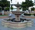
 La plaza in central Cocula. | |
 Flag | |
| Nicknames: La Cuna del Mariachi "The Cradle of Mariachi" | |
.png.webp) Location in Jalisco | |
 Cocula | |
| Coordinates: 20°21′54″N 103°49′19″W / 20.365°N 103.822°W | |
| Country | Mexico |
| State | |
| Municipality | Cocula |
| Government | |
| • Municipal president | Miguel Ángel Ibarra Flores PRI |
| Elevation | 1,350 m (4,429 ft) |
| Population (2020) | |
| • Total | 29,267[1] |
| • City | 16,550[2] |
| • Demonym | Coculense |
| Time zone | UTC-6 (Central (US Central)) |
| • Summer (DST) | UTC-5 (Central) |
| Postal code | 48500 |
| Area code | 377 |
| Website | www |
Cocula (Nahuatl languages: Cocollán "ondulated place") is a city and municipality in the Mexican state of Jalisco. It is located 35 mi (56 km) southwest of Guadalajara, on Mexico Highway 80. It sits at an elevation of 4,460 feet (1,360 m). According to the 2020 census, the population of the municipality was 29,267 with 16,550 inhabitants living in the city. Other important towns in the municipality are Cofradía de la Luz, La Sauceda, and Santa Teresa.
Economy
The Cocula regional economy is primarily agrarian-based, growing not only maize and agave but also sorghum, chickpeas, alfalfa and mangoes, and is one of the nation's top sugar cane producers. It is also known for the raising of (to a lesser degree) pigs, poultry, goats, and cattle. Cocula City proper is also the head of local commerce, with a wide range of specialized retailers of food, clothing, housewares, farm & garden supply and construction materials; the city is also the primary center for general regional public services such as banks, hospitals, auto repair shops and other civic industries.
History

Cocula was called originally Cocollán or Cocolán, which has been interpreted to mean "ondulated place." Around the 12th century, some families of the Coca tribe who inhabited the Kingdom of Tonalá were forced to flee the area due to hostility towards them. A group guided by Huehuetztlatzin founded Cocollán in today's Acatlan de Juarez area.
Cocollán was destroyed at the beginning of the 16th century. They tried to establish themselves in the Tlajomulco area a few miles from there but were expelled by the local tribes. They ended up occupying the top of a mountain close to the original Cocollán site where they remained until the arrival of the Spaniards.
By 1520, Cocollán was an independent city under the rule of Chief Citlali (The Star). It had some tributary towns under its control like Acatlan, Villa Corona, Tizapanito, Xilotepetque and Tecolotlán. In 1521, the Spanish army under Alonso the Avalos conquered Cocollán and surrounding towns and incorporated them into the Avalos Province. A few years later, Franciscan friars persuaded the indigenous inhabitants of the city to relocate to a valley nearby, which is its present location. This is believed to have happened in 1532. There are still remains of the old city, which is referred to as Cocula Vieja (Old Cocula).
In 1833, Cocula was declared a city, Cocula is best known as the birthplace of mariachi.
Culture
Cocula is referred to as "La Cuna del Mariachi," or "The Cradle of Mariachi," given that mariachi music originated there in the 19th century. As one enters or exits Cocula, two large arches, featuring two guitars or violins, bear the inscription "Bienvenidos a Cocula, Cuna Mundial del Mariachi." Many well known mariachi groups have come from Cocula and surrounding areas. A famous Mexican Artist named Jorge Negrete sang a song called "Cocula" that talks about this town and how mariachi originated there.
Government
Municipal presidents
| Municipal president | Term | Political party | Notes |
| José Corona Ochoa | 1914 | ||
| José Sánchez N. | 1916 | ||
| Gabriel H. Tortolero | 1916–1917 | ||
| José María Castillo Jiménez | 1918–1919 | ||
| Juan O. Hernándezz | 1918–1922 | ||
| Pablo Preciado | 1922 | ||
| Francisco M. Díaz García | 1924 | ||
| Salvador Molina Rojas | 1925 | ||
| Juan V. Grajeda | 1926 | ||
| Sóstenes Castillo | 1927 | ||
| Gerardo Rodríguez Tapia | 1932 | PNR |
|
| Francisco Pérez Camacho | 1934–1935 | PNR |
|
| Luis Vargas Pulido | 1935 | PNR |
|
| Tomás Ramírez | 1936 | PNR |
|
| Aurelio Aréchiga Rubio | 1936 | PNR |
|
| Pablo Vázquez Barboza | 1937 | PNR |
|
| Celerino Acosta Vargas | 1938 | PRM |
|
| J. Ventura Virgen | 1940 | PRM |
|
| José de Jesús Aréchiga Terán | 1941–1942 | PRM |
|
| Ignacio Arriola Ochoa | 1943–1944 | PRM |
|
| Encarnación Vázquez Nuño | 1945 | PRM |
|
| José Agustín Valdez Vázquez | 1946 | PRI |
|
| José Guadalupe Acosta Bañuelos | 1946 | PRI |
|
| Francisco Ixtláhuac Aréchiga | 1947–1948 | PRI |
|
| Celerino Acosta Vargas | 1949 | PRI |
|
| Enrique Acosta Tortolero | 1950–1951 | PRI |
|
| José Raimundo Ibarra Rodríguez | 1953–1954 | PRI |
|
| Celerino Acosta Vargas | 1955 | PRI |
|
| Guadalupe Ibarra R. | 1956–1958 | PRI |
|
| Miguel Allende Morales | 1959–1960 | PRI |
|
| Juan Ramírez Nuño | 1960–1961 | PRI |
|
| Francisco Vázquez Vázquez | 1962 | PRI |
|
| Manuel Terán Mariscal | 1964 | PRI |
|
| J. Jesús Águila Díaz | 1965–1967 | PRI |
|
| Enrique Silva Plazola | 1967 | PRI |
Acting municipal president |
| Rafael Montelongo Rangel | 01-01-1968–31-12-1970 | PRI |
|
| J. Luis López Ibarra | 01-01-1971–31-12-1973 | PRI |
|
| Carlos Ramírez Corona | 01-01-1974–31-12-1976 | PRI |
|
| José Ixtláhuac Virgen | 01-01-1977–31-12-1979 | PRI |
|
| Jorge Virgen Serrano | 01-01-1980–31-12-1982 | PRI |
|
| Rafael Vázquez Amador[3][4] | 01-01-1983–1985 | PRI |
|
| Carlos E. Arriola Pérez | 01-01-1986–31-12-1988 | PRI |
|
| J. Luis Ibarra Moreno[5] | 01-01-1989–1992 | PRI |
|
| J. Luis Facundo Guerrero[6] | 1992–1995 | PRI |
|
| Arturo Facundo Ramírez[7] | 1995–1997 | PRD |
|
| Juan Carlos Orozco Flores[8] | 01-01-1998–31-12-2000 | PRD |
|
| Gustavo Cabral González[9] | 01-01-2001–31-12-2003 | PAN |
|
| Antonio Vázquez Medina[10] | 01-01-2004–31-12-2006 | PAN |
|
| Arturo Facundo Guerrero[11][12] | 01-01-2007–31-12-2009 | PRD PT |
|
| Héctor de Jesús Castillo Andrade[13] | 01-01-2010–30-09-2012 | PAN |
|
| Félix Alberto Ibarra Vázquez[14] | 01-10-2012–30-09-2015 | PAN |
|
| Francisco Javier Buenrostro Acosta[15] | 01-10-2015–30-09-2018 | PRI PVEM |
|
| Miguel de Jesús Esparza Partida[16] | 01-10-2018–05-03-2021 | PT Morena PES |
|
| Miguel Ángel Ibarra Flores | 01-10-2021–30-09-2024 | PRI |
Gallery
 Cocollán (Hieroglyphic)
 Unofficial Flag of Cocula
 Parroquia de San Miguel Arcángel
 Templo de la Cruz
 Plaza principal
 Templo de San Juan
 Templo de San Pedro
 Kiosco
 Fuente
 Entrada y salida principales
 Cementerio Municipal
 Monumento a La Madre
 Plaza de Villa de Cázarez
 El Salto
 El Salto
 Presa
Presa Maguey
 Biznaga
References
- ↑ INEGI, Censo de Población y Vivienda 2020, http://cuentame.inegi.org.mx/monografias/informacion/jal/poblacion/default.aspx?tema=me%26e=14
- ↑ INEGI Archivo histórico de localidades geoestadísticas https://www.inegi.org.mx/app/geo2/ahl/
- ↑ "Enciclopedia de los Municipios y Delegaciones de México. Jalisco. Cocula" (in Spanish). Archived from the original on 1 October 2017. Retrieved 20 September 2021.
- ↑ "Consejo Electoral del Estado de Jalisco. CEEJ. Cómputo del Consejo Electoral del Estado de Jalisco en las Elecciones de munícipes, 1982. Cocula. PRI: 4676 votos. Partido Demócrata Mexicano (PDM): 203 votos" (PDF) (in Spanish). Retrieved 20 September 2021.
- ↑ "Consejo Electoral del Estado de Jalisco. CEEJ. Resultados de la elección de munícipes, 1988. Cocula. PRI: 4878 votos. PAN: 1509 votos. CCJ: 1230 votos" (PDF) (in Spanish). Retrieved 20 September 2021.
- ↑ "Consejo Electoral del Estado de Jalisco. CEEJ. Elección de munícipes, 1992. Cocula. PRI: 3862 votos. PRD: 1916 votos. PAN: 1098 votos" (PDF) (in Spanish). Retrieved 20 September 2021.
- ↑ "Consejo Electoral del Estado de Jalisco. CEEJ. Elección de munícipes, 1995. Cocula. PRD: 5194 votos. PRI: 3203 votos. PAN: 1960 votos" (PDF) (in Spanish). Retrieved 20 September 2021.
- ↑ "Consejo Electoral del Estado de Jalisco. CEEJ. Resultados de la elección de munícipes, 1997. Cocula. PRD: 3905 votos. PAN: 2921 votos. PRI: 2487 votos" (PDF) (in Spanish). Retrieved 20 September 2021.
- ↑ "Consejo Electoral del Estado de Jalisco. CEEJ. Resultados de la elección de munícipes del 12 de noviembre de 2000. Cocula. PAN: 3873 votos. PRD: 2973 votos. PRI: 2238 votos. Partido del Trabajo (PT): 1392 votos" (PDF) (in Spanish). Retrieved 20 September 2021.
- ↑ "Consejo Electoral del Estado de Jalisco. CEEJ. Integración de votos correspondientes a cada partido por municipio, elecciones del año 2003. Cocula. PAN: 3921 votos. PRI: 2986 votos. PRD: 2518 votos. PT: 593 votos" (PDF) (in Spanish). Retrieved 20 September 2021.
- ↑ "Listado de presidentes municipales electos, Jalisco" (PDF) (in Spanish). Retrieved 20 September 2021.
- ↑ "Consejo Electoral del Estado de Jalisco. CEEJ. Resultado de los cómputos municipales, 5 de julio de 2006. Cocula. PVEM: 4048 votos. PRD-PT: 4035 votos. PAN 3777 votos. PRI: 2864 votos. Partido Nueva Alianza (Panal): 677 votos. PVEM: 346 votos" (PDF) (in Spanish). Retrieved 20 September 2021.
- ↑ "Instituto Electoral y de Participación Ciudadana del Estado de Jalisco. IEPC Jalisco. Proceso electoral 2009. Regidores de mayoría relativa, y de representación proporcional. Cocula. PAN: 4566 votos. Convergencia: 3636 votos. PRD: 1944 votos. PRI-Partido Nueva Alianza (Panal): 1498 votos. PT: 573 votos" (PDF) (in Spanish). Retrieved 20 September 2021.
- ↑ "Instituto Electoral y de Participación Ciudadana del Estado de Jalisco. IEPC Jalisco. Integración ayuntamientos 2012. Anexo V. Cocula. PAN: 5377 votos. PRI-PVEM: 3861 votos. MC: 2190 votos. PRD: 2126 votos" (PDF) (in Spanish). Retrieved 20 September 2021.
- ↑ "Instituto Electoral y de Participación Ciudadana del Estado de Jalisco. IEPC Jalisco. Resultados de la elección de munícipes. Proceso electoral local ordinario 2015. Integración de ayuntamientos 2015. Cocula. PRI-PVEM: 4889 votos. MC: 3108 votos. PAN: 2084 votos. Partido Humanista (PH) 1843 votos" (PDF) (in Spanish). Retrieved 20 September 2021.
- ↑ "Instituto Electoral y de Participación Ciudadana del Estado de Jalisco. IEPC Jalisco. Integración de ayuntamientos, 2018. Anexo 4. Cocula. Candidato independiente Óscar Daniel Carrión Calvario: 6149 votos. PRI: 2709 votos. Morena: 1837 votos. MC: 1420 votos. PRD: 1320 votos. PAN: 523 votos. PES: 371 votos" (PDF) (in Spanish). Retrieved 20 September 2021.
External links
- Official Municipal Government Website (Spanish)