Compiano | |
|---|---|
| Comune di Compiano | |
 Compiano | |
 Coat of arms | |
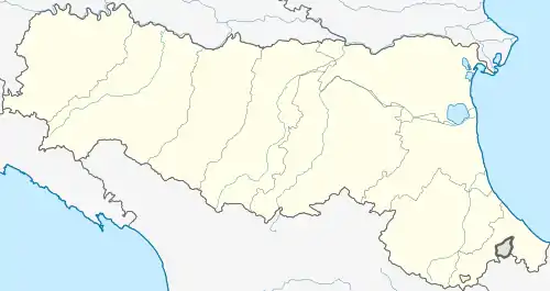
Location of Compiano | |
 Compiano Location of Compiano in Italy  Compiano Compiano (Emilia-Romagna) | |
| Coordinates: 44°29′50″N 09°39′45″E / 44.49722°N 9.66250°E | |
| Country | Italy |
| Region | Emilia-Romagna |
| Province | Parma (PR) |
| Frazioni | Barbigarezza, Breia, Caboara, Casello, Cereseto, Costa, Farfanaro, Isola, Piano Moglie, Ponte, Rio, Roncodesiderio, Sambuceto, Strela, Sugremaro, Trario |
| Government | |
| • Mayor | Sabina Delnevo |
| Area | |
| • Total | 37 km2 (14 sq mi) |
| Population (31 May 2007)[2] | |
| • Total | 1,092 |
| • Density | 30/km2 (76/sq mi) |
| Time zone | UTC+1 (CET) |
| • Summer (DST) | UTC+2 (CEST) |
| Postal code | 43053 |
| Dialing code | 050 |
| Website | Official website |
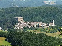
Compiano (Parmigiano: Cumpiàn) is a medieval walled town in the Taro Valley (Parmesan Apennines), a 50 minute-drive to the Ligurian Sea and to Parma. It is one of I Borghi più belli d'Italia ("The most beautiful villages of Italy").[3]
The top of Compiano's hill is home to the medieval Castello di Compiano.
History
It was said the Grimaldis, the royal family of Monaco, have their roots right here. A marble plate hung on the castle wall reports all the royal families that have inhabited the castle since the year 800 AD.
References
- ↑ "Superficie di Comuni Province e Regioni italiane al 9 ottobre 2011". Italian National Institute of Statistics. Retrieved 16 March 2019.
- ↑ "Popolazione Residente al 1° Gennaio 2018". Italian National Institute of Statistics. Retrieved 16 March 2019.
- ↑ "Emilia Romagna" (in Italian). Retrieved 31 July 2023.
This article is issued from Wikipedia. The text is licensed under Creative Commons - Attribution - Sharealike. Additional terms may apply for the media files.
